Homer Spit

We got to Homer Spit on a glorious summer’s day!  Hasn’t been a whole lot of those on this trip, very different from our last trip to Alaska.  It was really windy when we arrived and got a bit more windy as the day went on, but the views were spectacular!!!  Later, after we set up the campsites, we headed down the spit and had a couple of beers over at the Salty Dawg, a true dive bar on the spit with extremely low clearances inside.   Then we walked over to Captain Paddies for Halibut.  It was one  of the best Halibut dinners I have experienced.  The place is nothing to look at really,  pretty much a tourist trap, almost a strip mall with a nicer facade.  Only “The Bus” had better Halibut in my opinion, and we will stop there on the way home; but Hyder, Alaska, is about 1,600 miles from here, so it will be a while.
It started to rain as we were leaving Captain Paddies and the wind made it a “driving rain”.  Lucky for us, it wasn’t actually raining hard yet, but the wind made it seem like it was raining pretty hard.

The next day was “shopping” day.  The merchants in town were very grateful for the money we left them.   Picked up some sweatshirts and tee shirts, and the much needed refrigerator magnet from the Salty Dawg!   Dusty even got a rain coat and a new jacket to help with the cold weather we have been experiencing.  (Now it will probably warm up, but I am sure he will get a lot of use on the way back home.)


We went out for Kathy’s Birthday celebration a couple nights after arriving. She chose Fat Olives up in Homer itself.  She couldn’t believe how good the Kachemak Bay Bowl was.   It was so good she had me take a picture of it so she could post it in the Tiffin Eats group online.  My pizza was over the top good too.   It probably was as good as the little pizza joint in Tribeca I would frequent when back East, but this pizza was a close second.

On Thursday morning we woke up to a ship at the Homer Spit dock, it was the Hanseatic Nature cruise ship.   A smaller, 500′ long cruise liner holding maybe 240 passengers on a 20-day trip from Sapporo, Japan, to Seward, Ak.


We drove back up the peninsula a bit to Anchor Bay to watch the crazy boat recoveries I had heard about.  That was so fascinating I had a hard time believing it when I was originally told how it worked.  But it was real, and I hadn’t seen anything like it before.  They made it look normal.  The video below shows how they do it.

When we got back to the coach, Kathy wanted me to get takeout from Fat Olives, pizza this time.   It was just as good as the first time.


TSUNAMI ALERT 11 pm Saturday night!!     We had seen articles and even a few pictures about Tsunami alerts for the Homer Spit, and still we were very unprepared when it happened.   When my phone went off just after falling asleep Saturday night, I was in shock.  I told Kathy what the alert and was we both jumped out of bed and started getting clothes on and quickly figuring out what we had to have in case a tsunami actually hit the motorhome.   We needed phones, charger(s), laptop & charger, dog food and medicines, a change of clothes would have been nice, but that was an afterthought.  And we had no information about the Tsunami,  how long before it might hit us, etc.  The only thing I knew was I didn’t feel an earthquake, so we might have a bit of time.

Larry came over to make sure we had heard it and within a few minutes of that they were gone.   Within 5 minutes of them, we were packed and in the car.   It was pouring rain and the road out (the only road) was full of cars moving very slowly.  That’s when I started hoping the Tsunami was coming from Japan or somewhere that could take a really long time to get here.  Within 5 to 6 more  minutes, the cars starting moving faster and we got off the spit and followed the Tsunami Evacuation signs I had seen when we were driving around the area.

We came to a T intersection and there the signs ended.   I sort of knew what was in each direction from the prior visit to Homer 4 years ago, so I turned to the right, drove past the airport and continued driving till we were at 300 feet of elevation.   I decided to stop when I could see a road sign indicating a significant downgrade.  We found a large driveway and pulled into that and turned the car around to face out to the road.  Cars and motorhomes streamed by for about a half hour.

We started looking at anything we could find on our phones.  Lucky for us there was a bit of cell service way out there and we could read what was going on.  We found a news site that said the alert on Homer Spit was a mistake.  I called the Homer PD and they acknowledged it was safe to go back.  The alert was really for the Cook Inlet on the other side of the peninsula.

I am going to make a go bag and figure out a place to keep it so if something happened we could get out faster.


Williwaw Campground in the Portage Valley

This campground is very nice, very secluded with no hookups and just a smidge of ATT cell service.  Our Starlink had no service at all due to the tall mountains ringing this campground.  It was pretty full every night we were there, if you go, make sure you get reservations for the bigger sites.

The drive to Williwaw was a bit White Knuckled.  The wind was howling and there were wind warnings.  We thought it was bad on the first leg from Palmer to Anchorage, but then we got on the section that runs along the northern Turnagain Arm.  That was worse than anything I had ever experienced.  Each time we came around a rock outcropping, the wind wanted to blow the bus off the road and into the water. After that first small “point”, I went a lot slower around all the rest.

The first mosquito I swatted with my new zapper, it sparked and lit on fire  for a second.  Wow!  Since then it’s been zapping them with its 2750 volts. Black Flag Zapper Racket

We drove over to Portage Lake on a blustery day, checked out the visitor center, and afterward we had to go check out the gift shop.  We checked out the glacier boat tour, but the boat was down for repairs, waiting for a part to come in from England.

After lunch we took a hike up the Trail of Blue Ice for a couple miles or so, swatting a zillion mosquitos while walking along.   About half way along the trail, a couple teenage girls came up to us and said they had stumbled upon a bear just ahead and wanted to know if they could walk with us. I noticed they didn’t have any bear spray with them.  Larry said sure, and proceeded to head toward the bear sighting.   And we kept going too.  I thought we should of course go the other way!   Luckily we didn’t see the bear and walked for another half hour, then turned around. The girls thanked us and kept going on toward the visitor center, which was probably another half mile away.  Then I noticed they were running up the trail.

We headed back and kept swatting the mosquitoes the whole way.  I wished I had brought the new zapper with me on that trek!

We hit a real rainy spell here in Williwaw, 3 straight days of rain without it ever stopping!  (Felt like 40 days and 40 nights).  I used the time to catch up on the blog and finishing the Perry Mason series.  We looked at driving over to Whittier for lunch but found out the only decent restaurant was closed.  We drove over anyway on one of the few sunny days.

While there we read a bit about that tunnel that was completed in 1943 as the main “highway” to move goods into Alaska for the war effort.   And a week later at the July 4th parade in Kenai, the woman sitting next to me told me when she was young, you could only get to Whittier via train or boat.  It opened to vehicle traffic on June 7, 2000 after a very extensive conversion from a World War II railroad tunnel.  It’s an odd experience as you straddle the rails when driving thru it as it’s only one car wide, meaning on the half hour you can go to Whittier from Portage and on the hour you can leave the city.   Good timing can save a lot of waiting!

With that in mind, we walked around a bit and then scrambled to get out of town on the hour;  and of coarse there was a train as we drove over,  and they were going to get thru the tunnel while it was outbound too.  We had to wait until after the train  cleared the other side of that very long tunnel.   It did and we proceeded to head back to Portage.

Once on that side of the mountain, we decided to drive over to Moose Flats to see if there were any moose to see.  There weren’t, so we headed back to Williwaw for the afternoon.

WhittierTrain

That evening we all drove over to the Double Musky for dinner.  It was a Cajun place out here in the middle of nowhere in Girdwood.   I tried the Gumbo and it wasn’t that good.  I think they burned the Roux.  I had the Jambalaya, which was good, probably a 6 of 10 on my Jambalaya scale.

Our Starlink did not work at all while at our site in the Williwaw campground.  I believe the problem was the tall mountains ringing that area only allowed us to connect when a satellite was directly overhead, and there aren’t many sats in the north latitudes yet.   We were able to extend our 4×4 MIMO Cellular antenna up off the roof on the batwing and get some AT&T signal.  It averaged -120dbm or worse.   I tried to use B14 but couldn’t get any signal with that, so I had to settle for B12 and a few other high-frequency bands aggregated together.   So surfing the web was not a fast thing, but we could check the weather and do emails and other internet things.


2023 Escapade (Tucson)

Drove over to Tucson for Escapade this spring.   Met up with friends Tami and Scott and traveled in together so we could park next to one another.   We were escorted out to the fence line on the south 40 of the property.   Not sure if it was a further walk to the main buildings than the last time we attended, but it sure seemed like it.   I guess you need to know someone to get reasonably close camping.

After our arrival  Saturday morning, I deployed my new 4-panel suitcase to see how well it worked with the sun relatively low in the sky.  It was pretty windy that morning, so I had to employ my newly installed D rings and large lag screws to hold them down.  And lucky for us I did that,  because it only got windier as the week went on.   A couple of the days were pretty cloudy, and by the evening on the second day of clouds, my batteries were around 40% SOC.  Not a great starting point for the sun going down, better if it’s just coming up.

We were in the solar area and were not supposed to run our genny; but I decided no one was around to hear it and ran it for a couple hours, bringing the batteries up to ~90%.   7 days of boondocking and I needed to run the genny for 2 hours.  If it hadn’t  been very cloudy for a couple days in a row, I would not have needed the genny.  And I may have not needed it when I used it, but I had never let them get below 40% since I put them in back in 2019.   The below screenshot shows that 400 watts of panels putting out a respectable 364 watts of power at noon one of the days.

We got to test out the new Power Watchdog on the way there and back and our new roller shades in the front area of the bus.  I can’t believe I didn’t get a picture of the new solar suitcase deployed.   It really worked out very well for helping to keep the batteries topped off.

Emigrant Lake

On the way to Emigrant Lake we topped off our fuel tank as it was going to jump about a dollar a gallon just a few miles south of the lake at the California border.

We got there and the lake was Very low.   It was a very long way down to the water.  Even the ends of the boat ramps and floating docks were hundreds of feet from the edge of the water when we were there.

The campground side for larger vehicles is all the way at the end of the road on a tall peninsula.   It was interesting as we drove out there, I could feel the hairs on the back of my neck tingle as the height came into view over the rise.

Tami & Scott arrived the day after we got there as their repairs took a bit longer to complete the work they wanted done.   We did get to have lunch one day on the Ashland Riverwalk.   Nice small town, and lots of Oregonian folks.  You need to spend a bit of time in a small town in Oregon to know what I mean.

The best view site was RV21, a pull-thru overlooking the whole lake.  We were not in that site, but wished we were.

This park had the worst stickers Kathy has ever seen and it was impossible to walk Dusty unless we drove him to the day use area, which had nice lush grass.  The sign said no pets, but there were no people at this time of year so I dared it!

Valley of the Rogue

We were meeting back up with friends at this campground and staying for a few days.   When I was setting this camping up, I noticed how close it was to the 5 freeway.  So when we arrived and found our spot, I was pleasantly surprised how quiet it was.  And the Rogue River had a very small rapids area right across from us by Scott and Tami’s spot, so there was the sounds of the water right there making it a pleasant experience.

I spent some of the time there cleaning the basement that had gotten a bit dirty over the last several months.  Did some rearranging of stuff under there to lessen the weight on the right rear of the coach that I had found out about traversing a couple unoccupied weigh stations along the way to Champoeg.  (Shampoo)

One afternoon we headed over to Grant’s Pass for lunch along the Rogue River.  Was a pretty nice place with tables next to and overlooking the river.  Food was very good too.  (River’s Edge Restaurant)

One evening we were sitting outside our friends’ coach sipping on some beer and above us were hundreds of birds circling.  They looked like hawks to me and Scott thought they were turkey vultures.   I kept trying to get them into a picture but could only get some of them in any one shot.   They stuck around for a couple hours riding the thermals and dropping down and doing it again.  It was pretty cool as I had not seen that many birds doing anything like that before.


Manitou Springs morning walk

As I had mentioned in a prior post, we wanted to come back to walk around Manitou Springs some morning.   Today was the day.   Lots of touristy shops and restaurants and nice parks, and surprisingly lots of springs plumbed right into buildings or rocks on the side of the road.  Some a bit ornate, others just look like they grew there.  There were a few signs that explained the mineral content of each spring.

We walked uphill on the shady sidewalk till Kathy said she could go no more..  Then we went back down the other side of the narrow roadway, with cars and buses heading up the hill to the cog railway station, till we were done shopping and found a place to get lunch on the patio.

July 16th 2022

Garden of the Gods and the Academy Chapel

This was another place I found when we got to Colorado Springs and figured we would make a trip over to check it out.   It was a pretty amazing place.  You’d think it was a national park, but it’s actually a city park.   There are some pretty amazing rock formations of vibrant colors with smooth sidewalks paved to wander around all of them.   And another amazing thing is there wasn’t a charge to visit.  Most of the national parks are around $30 a day now.  I kept driving thinking I would find the pay station, but there wasn’t one.  Nice!

I call them rocks, but they were really 1,000-foot-tall mountains that just looked like one big rock.  It’s something you must see if visiting Colorado Springs and only have an hour or two.

I looked up the Air Force Academy Chapel to find out its hours, and it’s closed till 2027 for repairs.  What a bummer.   2027 is a long way away, there must be something terribly wrong with it.   July 16th 2022

Pikes Peak Cog Railway Trip

We purchased reserved seats for the Cog Railway out of Manitou Springs to the top of Pikes Peak for a 9:20 am departure.  We arrived early as everything we read said parking was scarce.  And it really was; but as we got there around 8:20, an hour before, we had no issues.  There was so little parking up there, I bet the 10 am train folks would be either walking a mile or two or would have to take a shuttle from parking down in the town.

Boarding time arrived fairly quickly and we found our seats.  We were in one of the older trains and the seats were two abreast and faced the two seat in front of you.  My knees were touching the seat in front of me.  Yikes!  Lucky for me a small child sat there. Some tall guys were across the aisle from us and their legs were straddling each other.   And then, we both lucked out even further as a woman gave up her seat a row in front of us to sit with friends elsewhere in the coach, and the folks in the seats facing us could move ahead to be with the rest of their family.  Wow!!   If I ever had to go again, I would buy all 4 seats for two of us.   The newer trains may have more room.  Looked like it from a distance.

The engine was fairly loud and roared all the way up to the top; and coming down, seemed a bit louder.   It’s a single-lane track with occasional sidings to allow trains to pass each other.  My thought is it’s normal to pass two trains on each way as they leave about 40 minutes apart.   It’s an extremely steep grade, so it makes sense they use a cog (gear) to keep moving at a safe speed.  It’s probably even more important when going back down.

The ride is about 1 1/2 hours each way with about 40 minutes at the top.  It’s windy and cold up there.  It was close to 90 in Colorado Springs and probably 40 at the top.   It’s over 14,000 feet, and you will notice how thin the air is just moving around, and the stairs will have you huffing and puffing in a few steps!  I guess one of the features of being up there is you get to see kids throwing up.  We got to see a couple.  Not sure if the parents had them eating at the snack bar or it was just the lack of oxygen or possibly a combination of both.  That part is not mentioned in the brochure.

I had purchased two cans of oxygen at a local store prior to going there just in case.  They are both still unopened.  I had read about them always being out of them at the top.  I didn’t see anyone else using them.  Ours never came out of the backpack.  They are in thin aluminum canisters that seem to be empty as they are so light.

Anyway, beautiful views in all directions while we were there.  We had picked a perfect day, hardly any clouds in the sky.   I had forgotten you can also drive to the top.  I was talking to a guy that had driven his Tesla up with his family.   I bet that regenerative braking was very helpful on the way back down!  I heard there was a brake check on the way down where someone comes out and lets you know if you can go further or not based on your brakes.  (temperature?) Not sure what happens if they determine your brakes are a problem.

The trip up and back down were uneventful, until the boy in the seat ahead of us started throwing up out the window.  Felt bad for him.  When we drove back down through Manitou Springs, we noticed it had a pretty nice old downtown and we would come back and visit if we had time later in the week.

July 14th 2022

Royal Gorge, Canon City, Cripple Creek and Victor Colorado

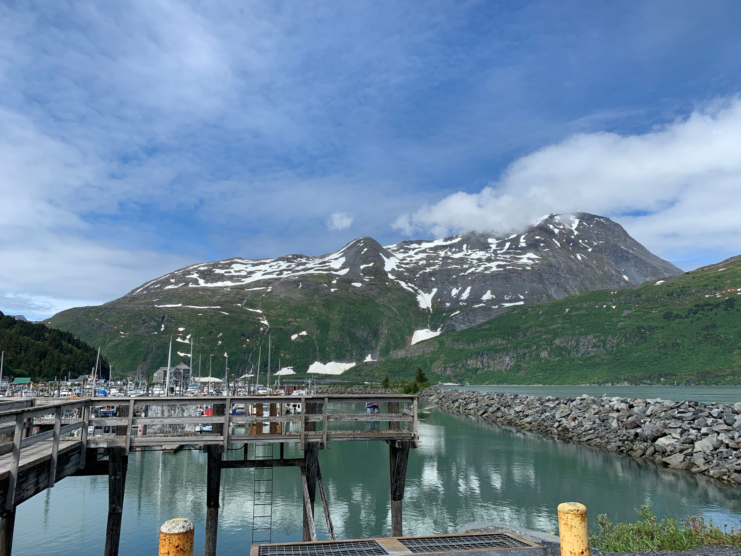
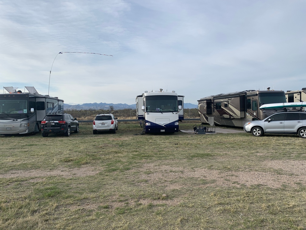
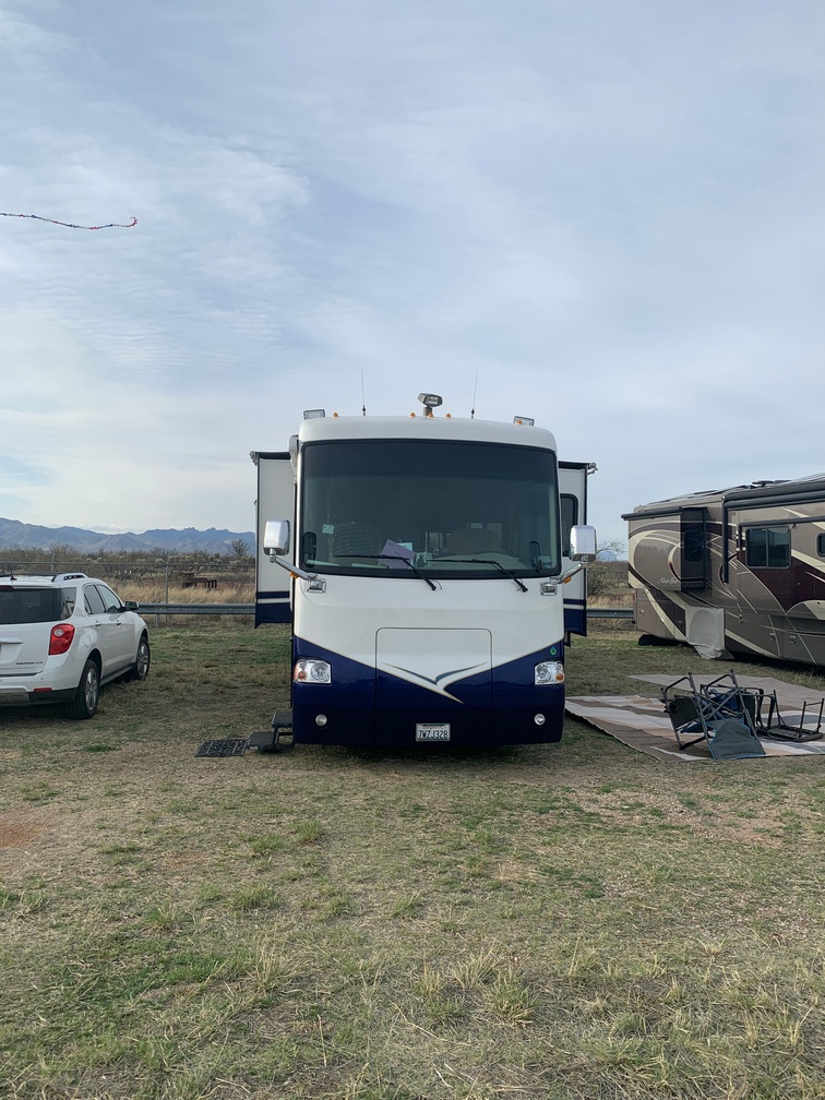
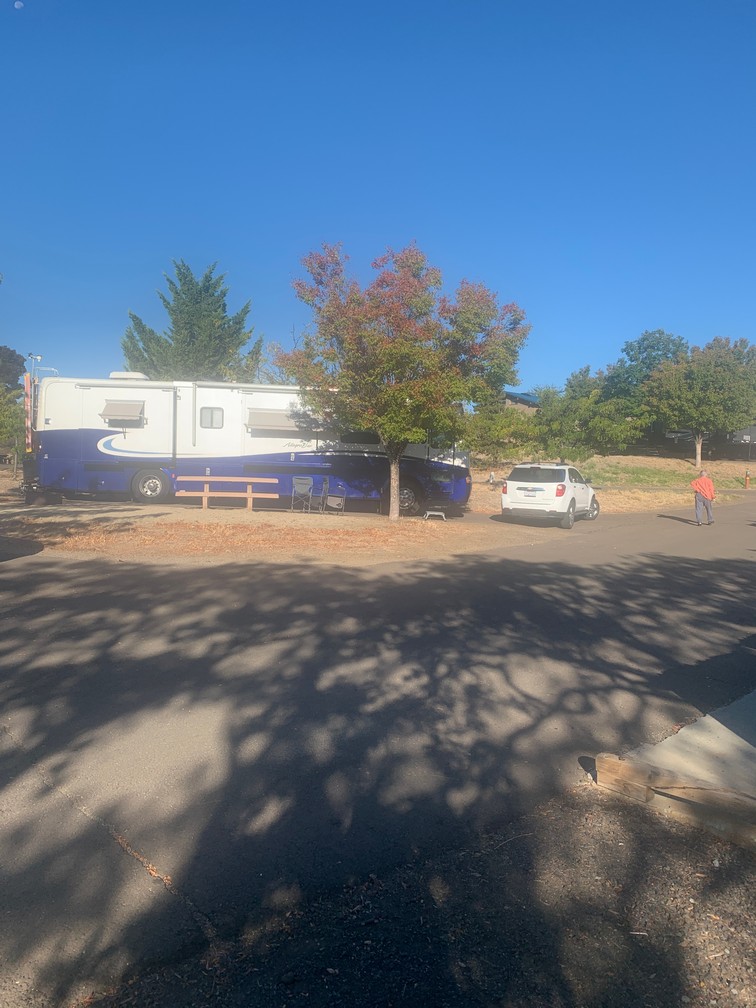
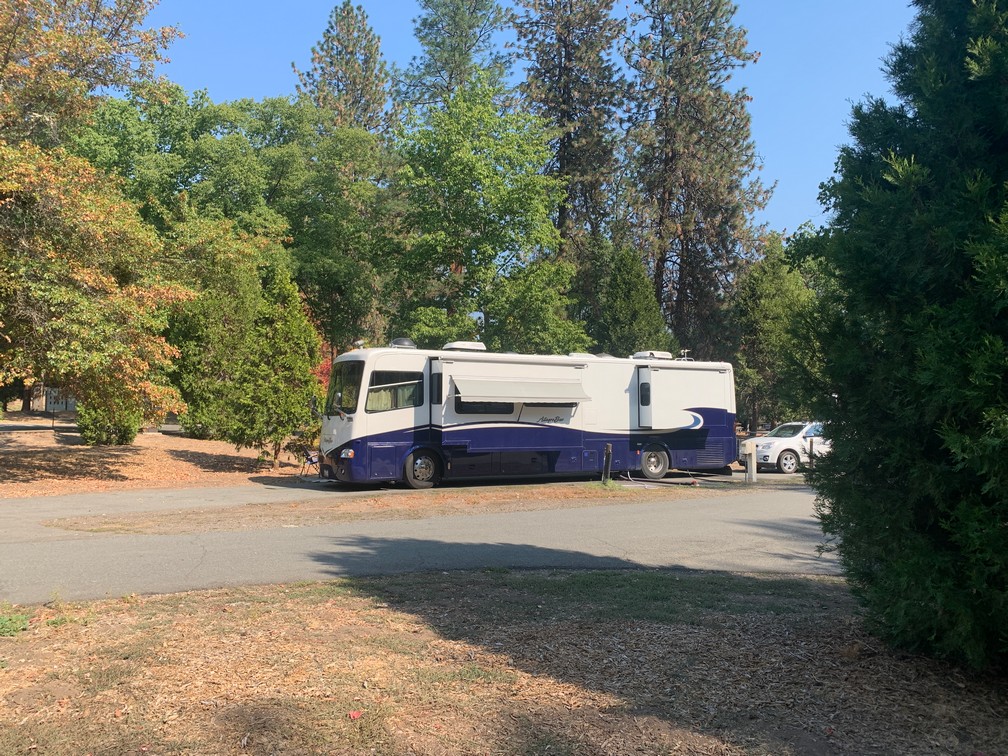
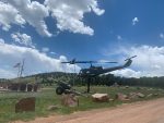
We left the convergence and drove about 30 miles east to a nice small campground just up the road from the Royal Gorge.  I didn’t know much about it but decided we would visit and know a lot more.

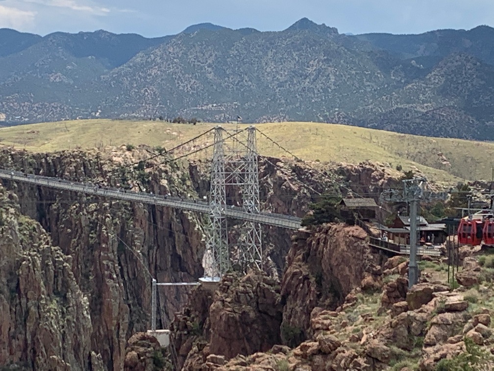
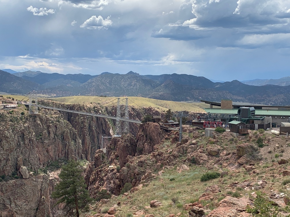
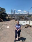
After setting up in our campsite, we drove over to the gorge that afternoon.  It 
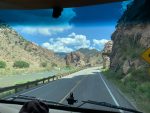
was very hot that day, so we just drove around to see what was there.  It struck me as odd, the bridge over the gorge was this huge suspension bridge and it seemed to go nowhere.   We decided to come back the next morning when it would be a lot cooler.

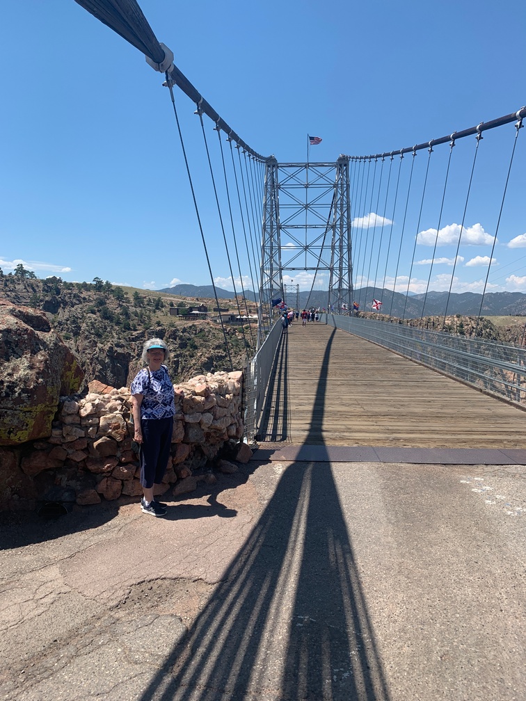
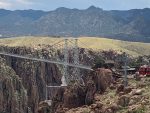
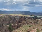
The next morning we drove back over there and paid to go into the “park”.  Turns out this whole thing is really an amusement park.  The bridge was built over the gorge strictly as a tourist attraction.  On the other side of the bridge, which you can only walk across now, is the amusement park.

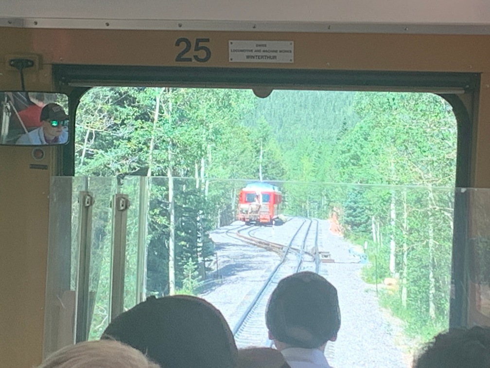
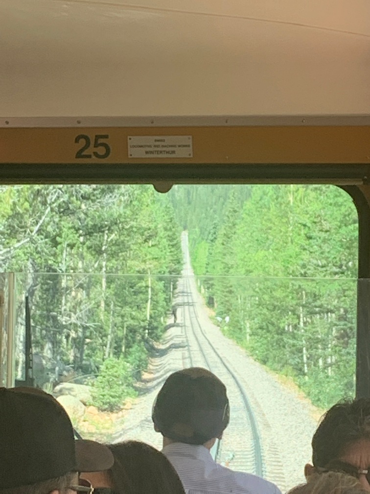
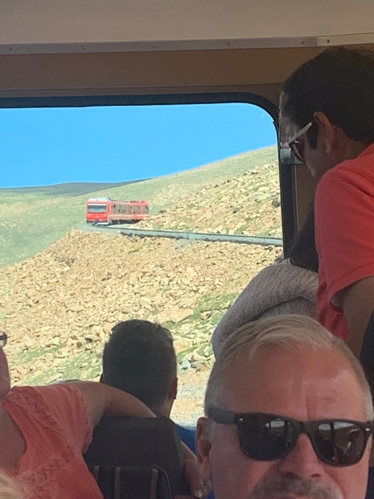
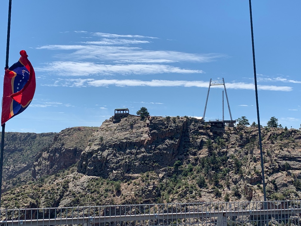
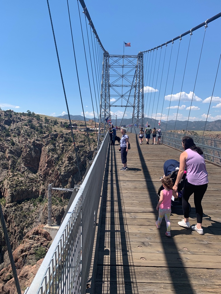
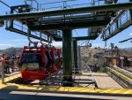
We decided to take the gondolas across then walk back over the bridge; but after being in line for it for about 15 minutes, they shut it down due to high winds.  And it was very windy!

There were also two ziplines that 
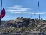
originated on the other (uphill) side of the gorge and people were zipping over.  They came in very fast, and there were rubber blocks on the line that slowed them down very quickly.  I was thinking whiplash might be a real possibility.  Those ziplines are over a thousand feet in the air.   Hard to imagine that.

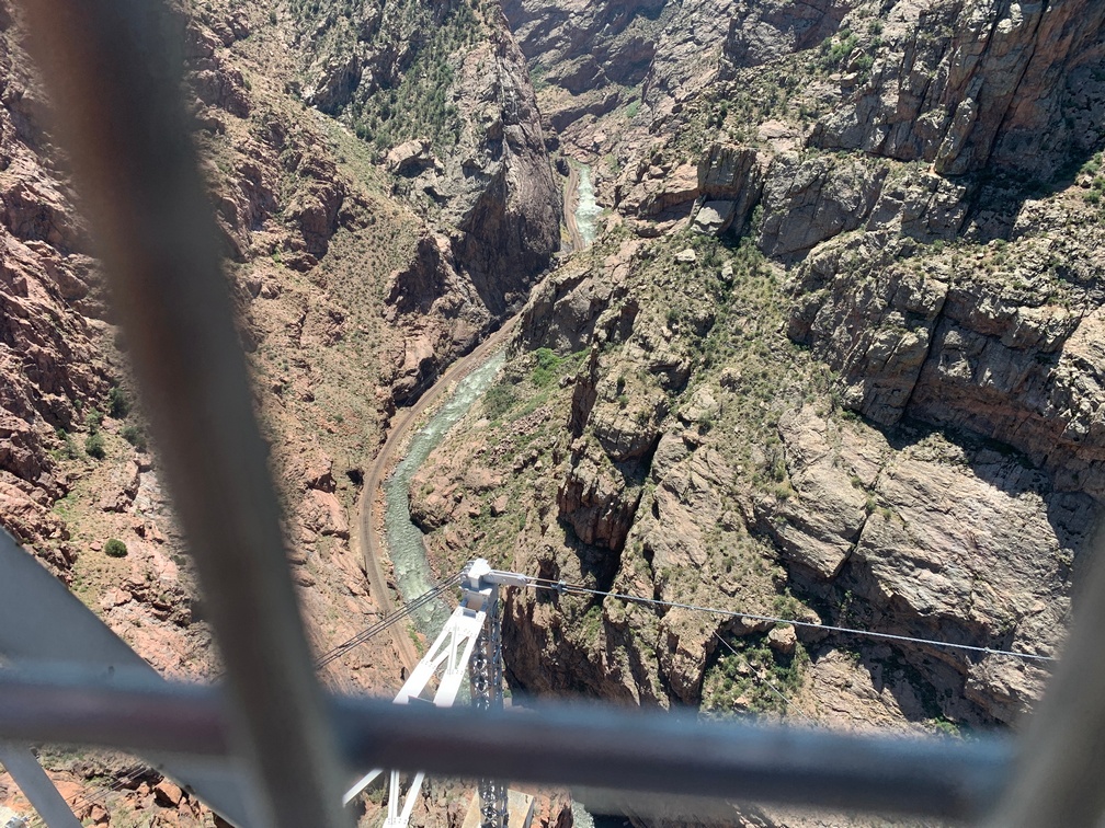
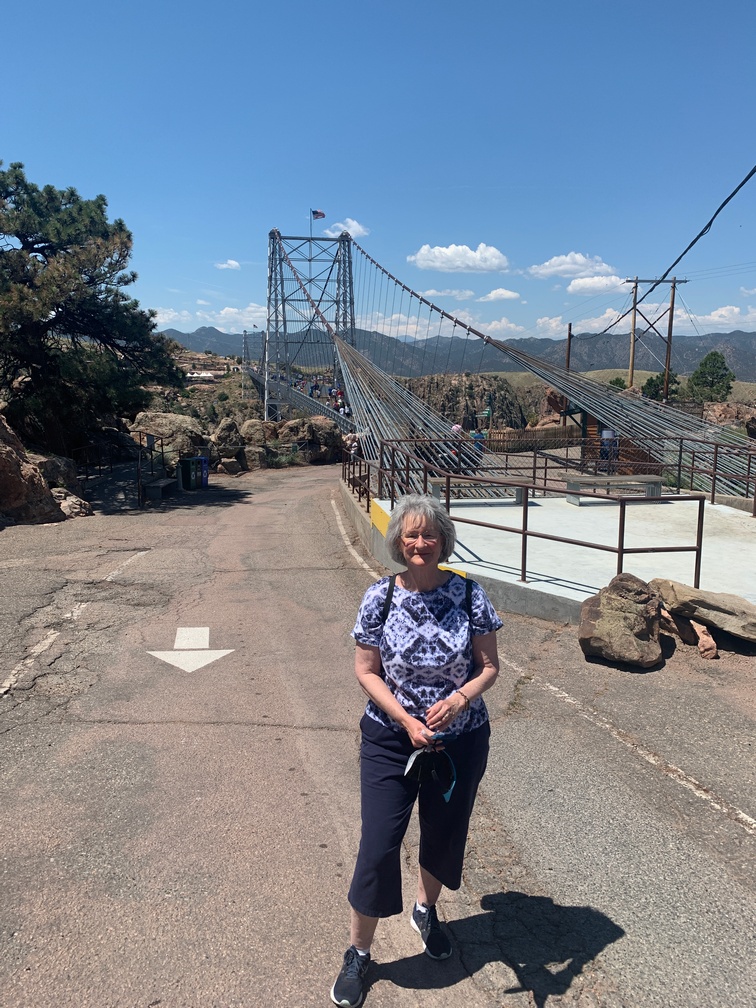
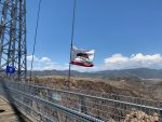
After the gondolas were shut down, we walked down to the beginning of the bridge, then out on it about halfway across.   We were glad we didn’t bring Dusty as it was so windy out there we probably would have needed to carry him or he could blow away!  I could feel the bridge moving and that’s not a comforting feeling.  We snapped a few pics and proceeded back across while watching my footsteps as there were a lot of older boards that didn’t look so sturdy to me anymore.


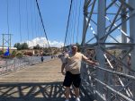
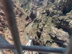
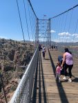
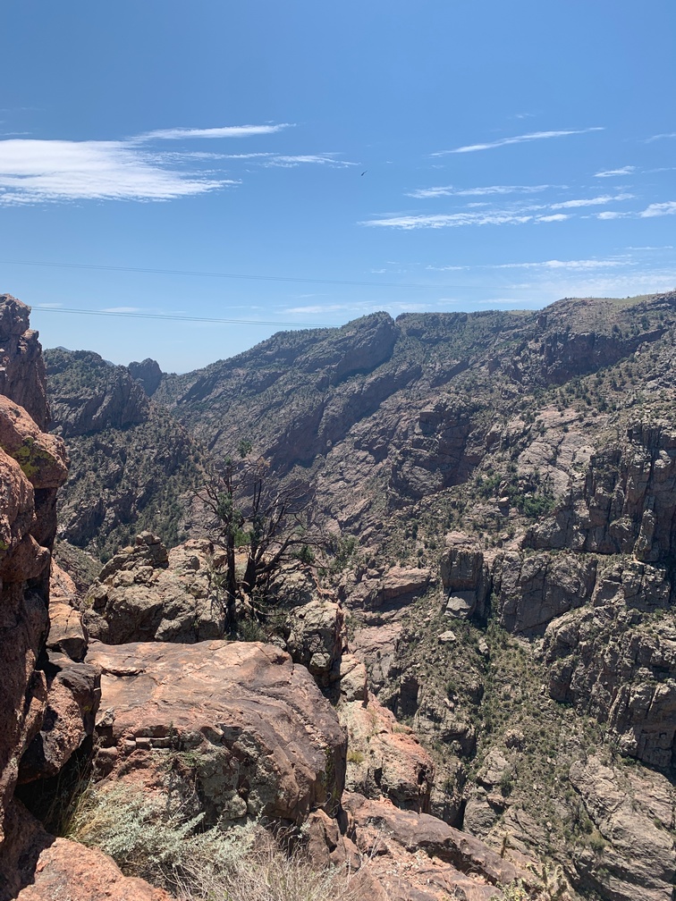
I’ve crossed a lot of bridges in my life, but I do not remember one that was anywhere near as high off the ground as this one.  It was about 1,000 feet above the Arkansas River below.  Interestingly, I saw a RxR track running alongside the river way down there.

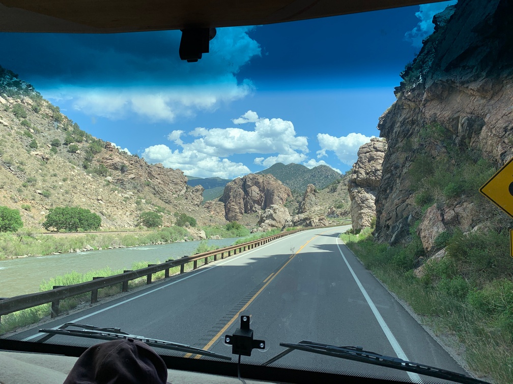
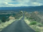
When we left there, we headed toward Canon City, just a few miles east of the gorge.  I had read something about Skyline Drive, so I decided to use that route to get into town.  That was quite a drive, not for the faint of heart.  Narrow one lane (lucky for us, one way also)  that traverses the top of a mountain ridge all the way to town.   There were a few parts that my acrophobia kicked in and it was all I could do to stay in the middle of that road and look at nothing else.  The dash-cam video shows just how small and high it is.   It comes out at the bottom of the hill after a few switchbacks right into a residential neighborhood.

First Half of Skyline Drive


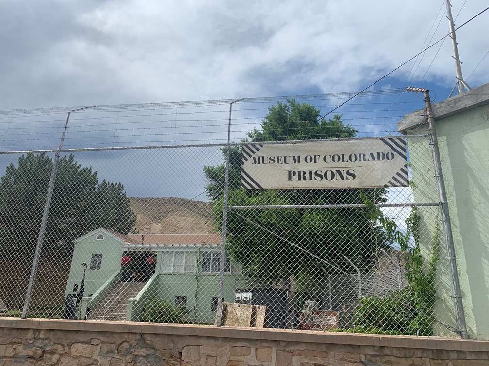
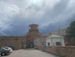
Not  far from the base of the end of Skyline Drive was the Colorado Prison Museum.  We drove by and they 
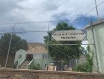
didn’t allow dogs inside and it was way too hot to leave him in the car.

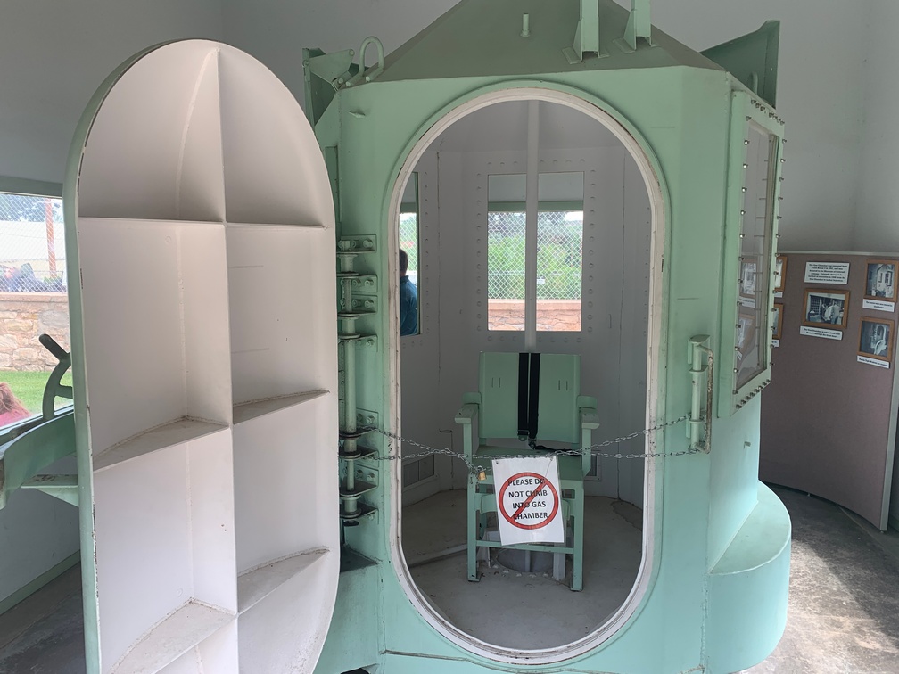
I did get to see the gas chamber they used there.  Interesting gadget.  The walls were very thick steel, something I would have expected on a diving bell to see the bottom of the Marianas Trench, not something for using at sea level.

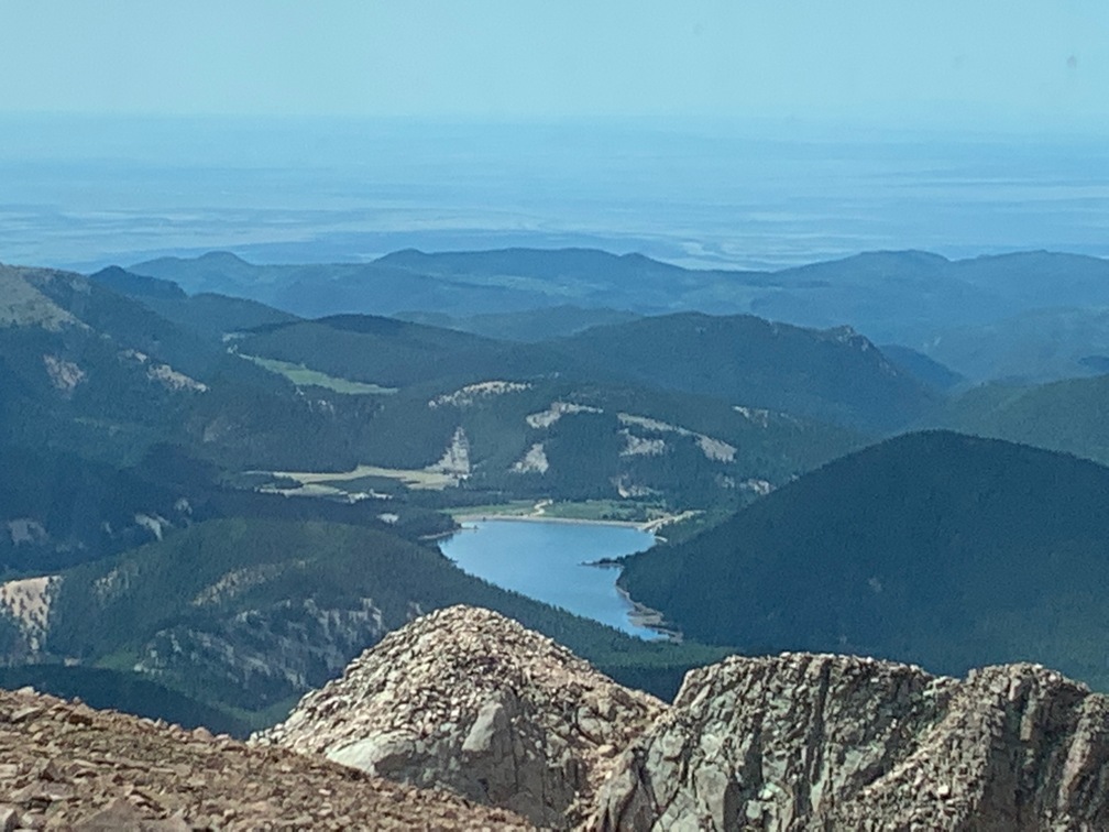
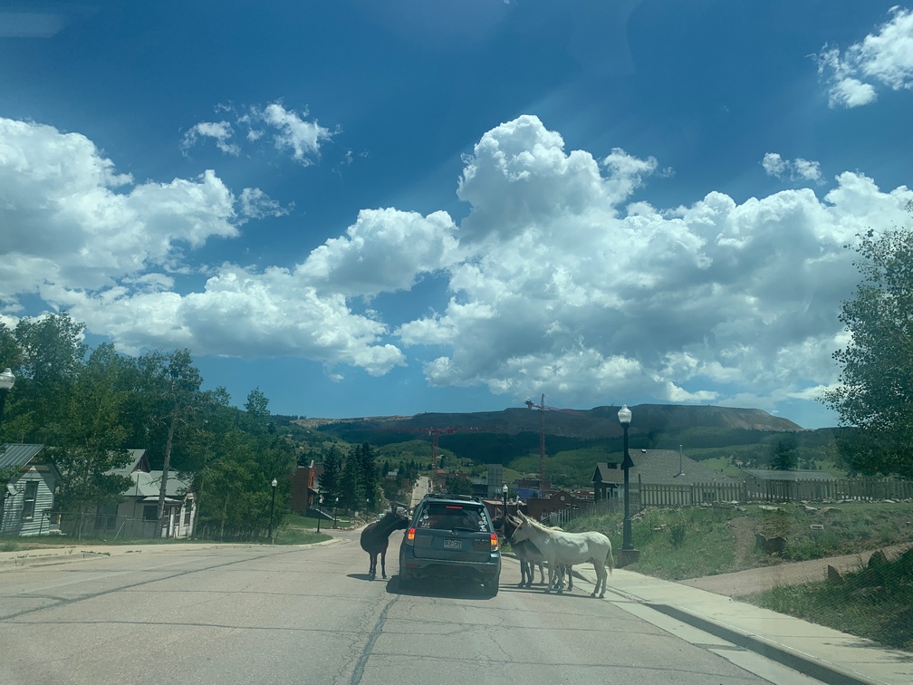
The following day we headed up to Cripple Creek, an old mining town in the mountains.  What a beautiful drive with everything green as far as you could see, miles and miles of trees and meadows with some cattle grazing along the way.

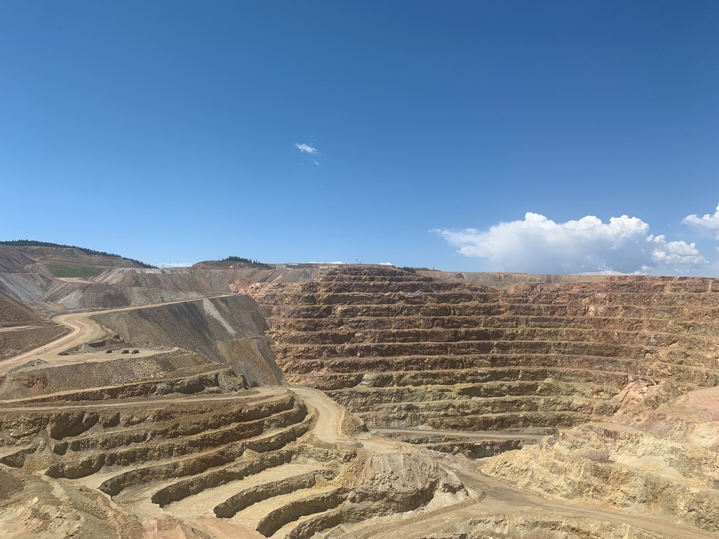
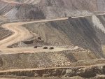
We got into town and we decided to drive thru it to see Victor first and then come back to CC.  On the way to Victor, we saw a very tall pile of dirt, I mean really, really tall and wide. It turns out it’s an active gold mine, a big open pit, but there appeared to be no way to see into it.  We drove for a few more miles, the whole time the wall of dirt was just to the left of us.

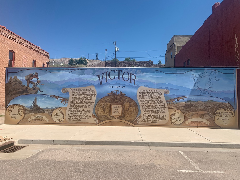
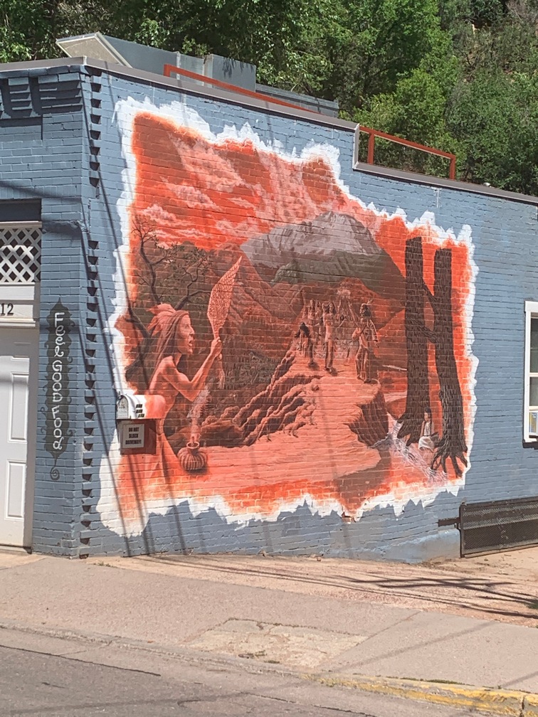
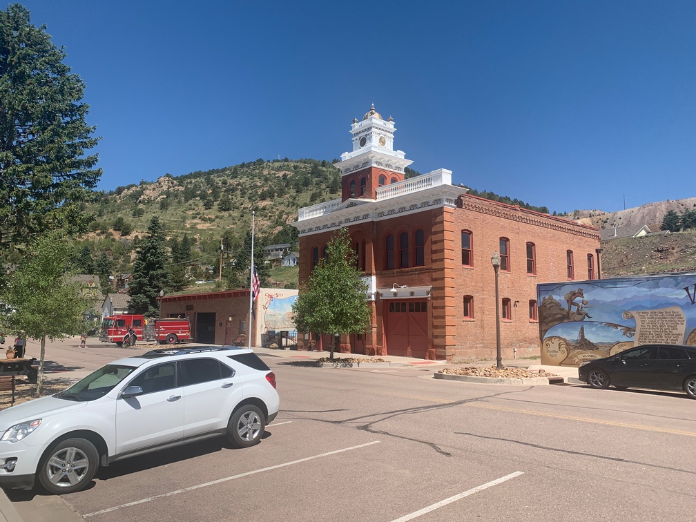
We arrived in Victor and it’s a really nice little mountain town, lots of old buildings.  We stopped at a small parking area across from the fire station and city hall.  Nice mural right there.   I saw a fireman outside washing his rig, so I 
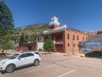
went over to talk to him, figuring he knew a lot about this town.  I knew nothing.

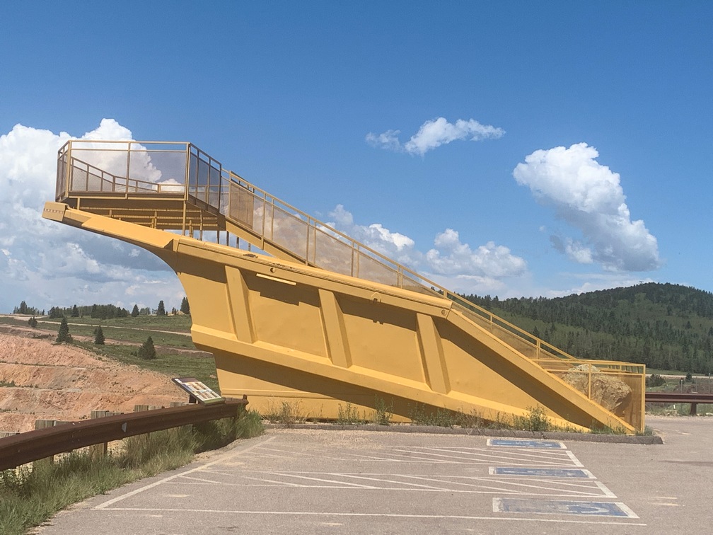
He turned out to be a wealth of information, and the best part was he knew a way to see into the big strip mine just up the road.   We wandered around the town for a little bit, then headed out, remembering the directions to the overlook.  They were a bit vague, but we found it anyway.

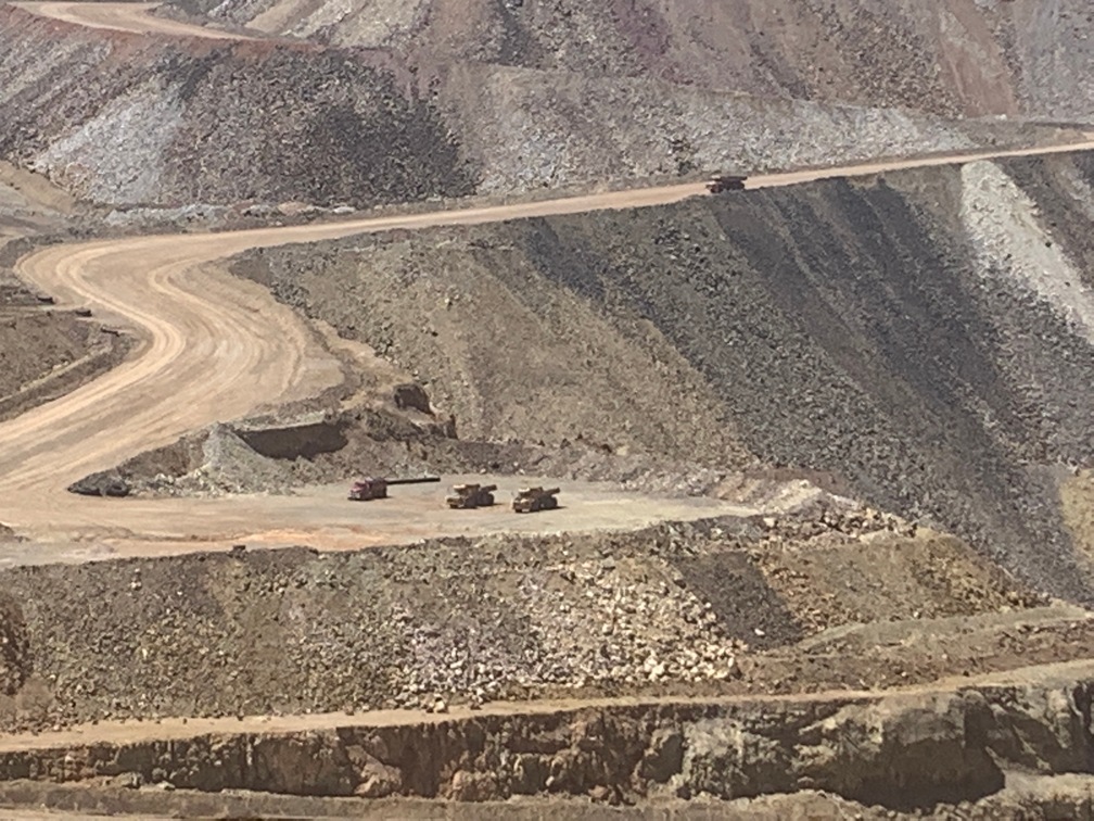
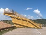
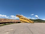
And it was spectacular!  Even the platform was over the top, made out of the bed of one of the old ore hauling truck beds with a platform and stairs welded into it.  
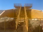
Quite an impressive structure.  And the view from it into the mine was great.   It’s an active mine and we saw trucks moving ore to and fro.

Turns out they produce more than half a billion dollars of gold per year.  Not chump change!   I didn’t know we had much gold mining in the US.

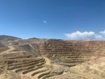
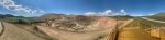
The pit is Huge, yes, with a capital H, huge.

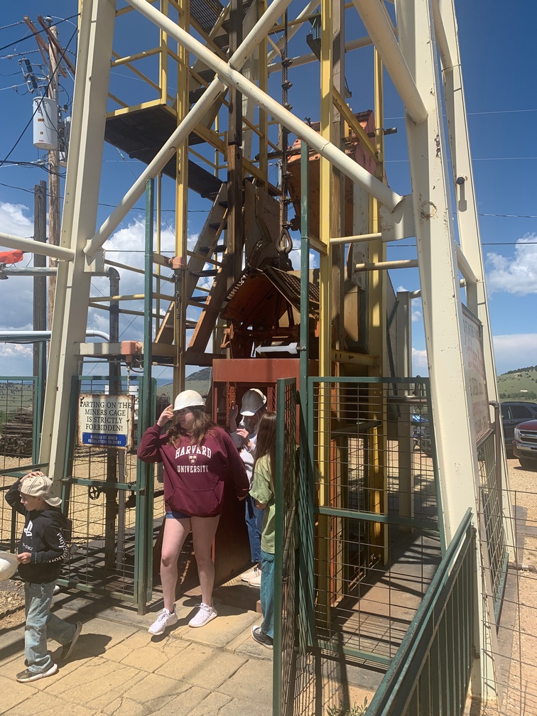
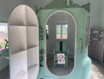
After spending time to take it all in, we headed back to Cripple Creek and along the way stopped at an old shaft gold mine that is now a tourist attraction.  There is a mine elevator that takes you down 1,000 feet and then you can explore the tunnels.  No dogs allowed and it was still very hot, so I just took a picture of the double-decker elevator that had just a single cable hauling it up and down.  Looked like a single point of failure to my eyes.

We drove the few miles into Cripple Creek, and the first thing you notice in the small town are the 500-foot-high cranes you see when they build skyscrapers, and they appear to be building some right in downtown.  I wasn’t really impressed by the town.  It appeared to only be a casino town.  Lots and lots of casinos.  Nothing much else there.

We wanted to get lunch, and there was nowhere that allowed pets and almost all were actually part of a casino.   We couldn’t even find a takeout place.  Sad.  We did find a nice pavilion on a slight hill with picnic tables in the shade to eat some snacks we brought for the drive.   It was odd, there wasn’t even a Subway to get  a sandwich in the town.  And they seem to be everywhere you look.

We noticed big, dark clouds in the west (the direction we had to go back) and I called the local police station asking about this other road I could see on the map that went almost directly south toward our campground, 50 miles away or so.    The dispatcher said it’s not a road for the faint hearted nor is it ever maintained as it goes along the river on a ledge for miles.  So no go.

We drove toward the storm.   But missed it, only skirting the edges and got a few sprinkles.   But when we got back to the coach, the wind was blowing hard and it started raining buckets of water.  I was glad I wasn’t driving a mountain road in that.

The next morning I drove down to the prison museum by myself and took the tour.  Pretty underwhelming.  Old and musty place.  It was worth the $3 to get in, but just barely.

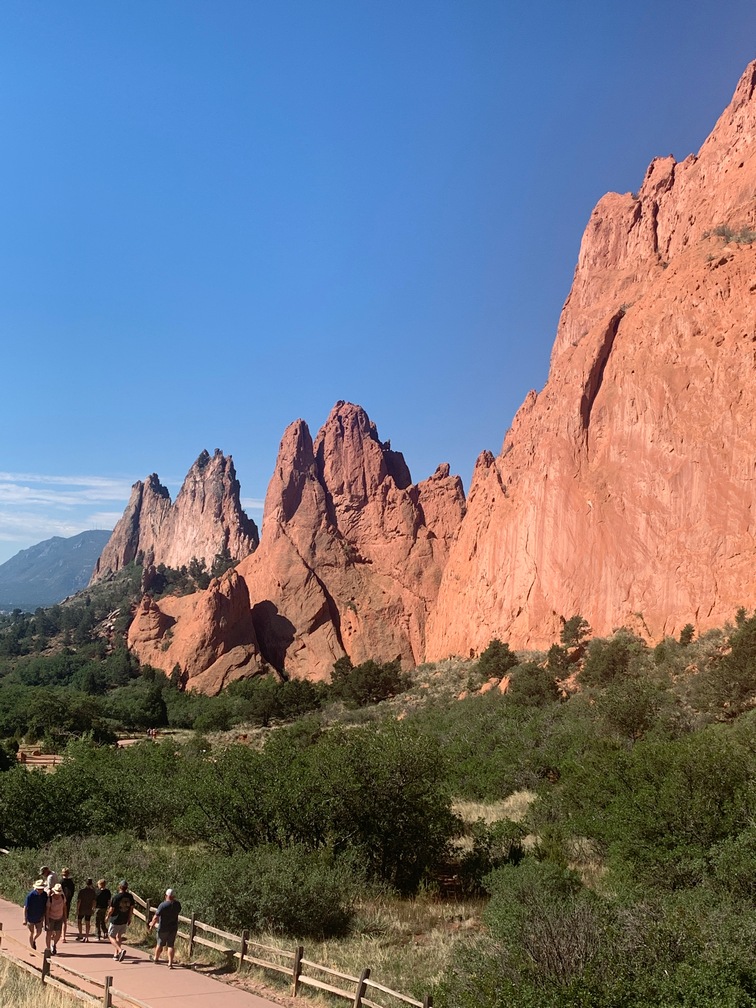
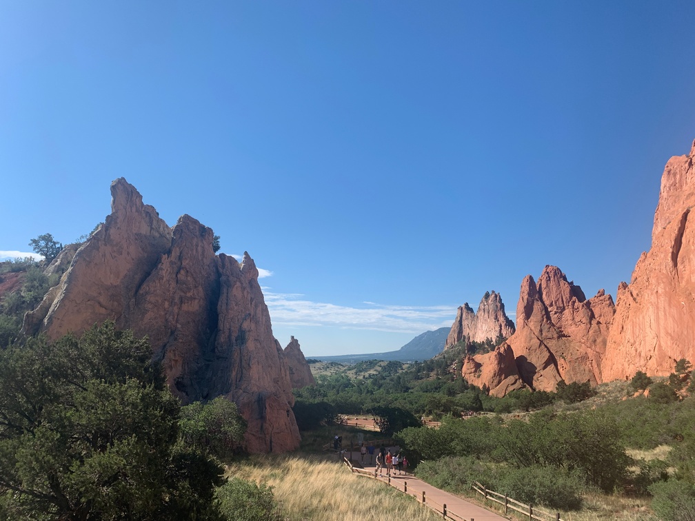
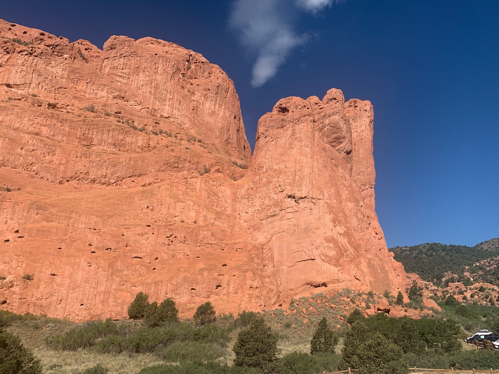
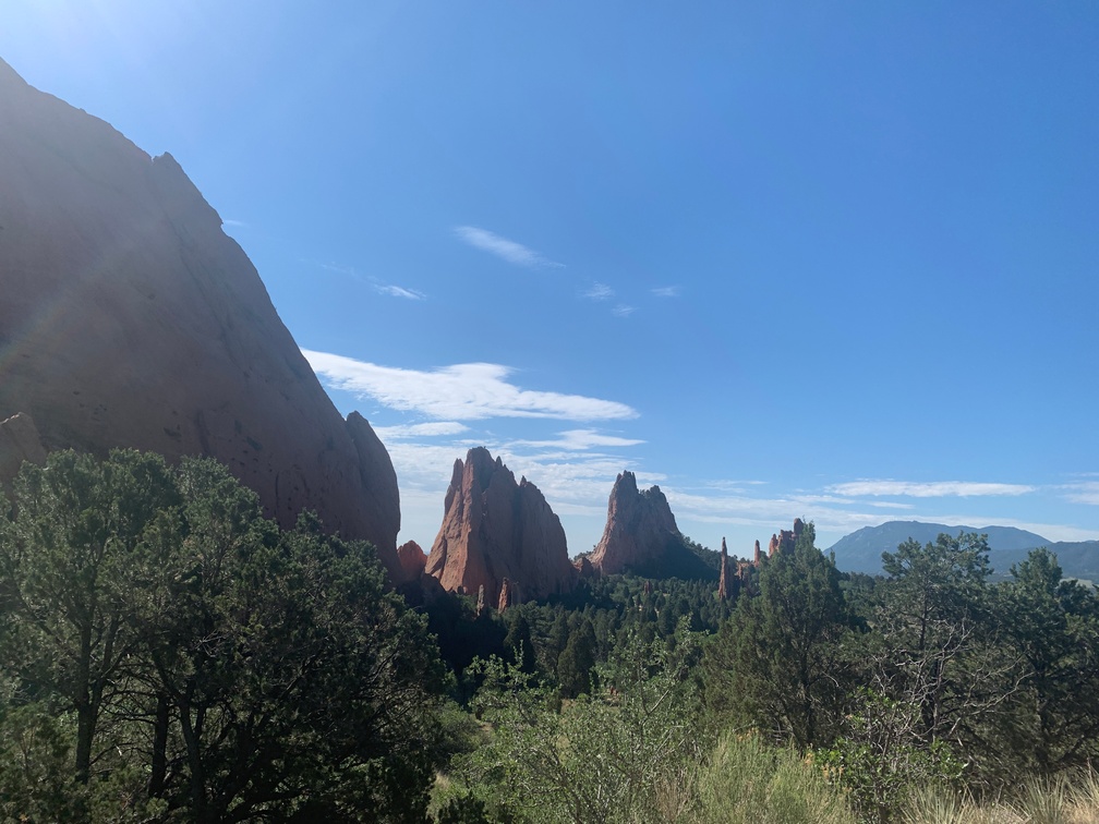
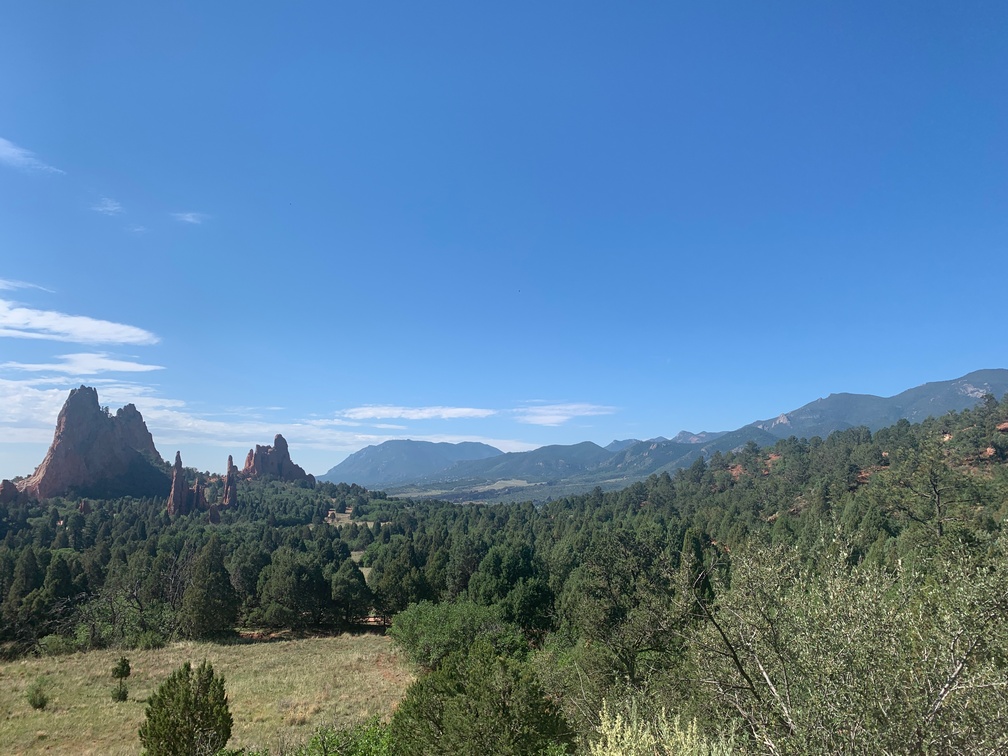
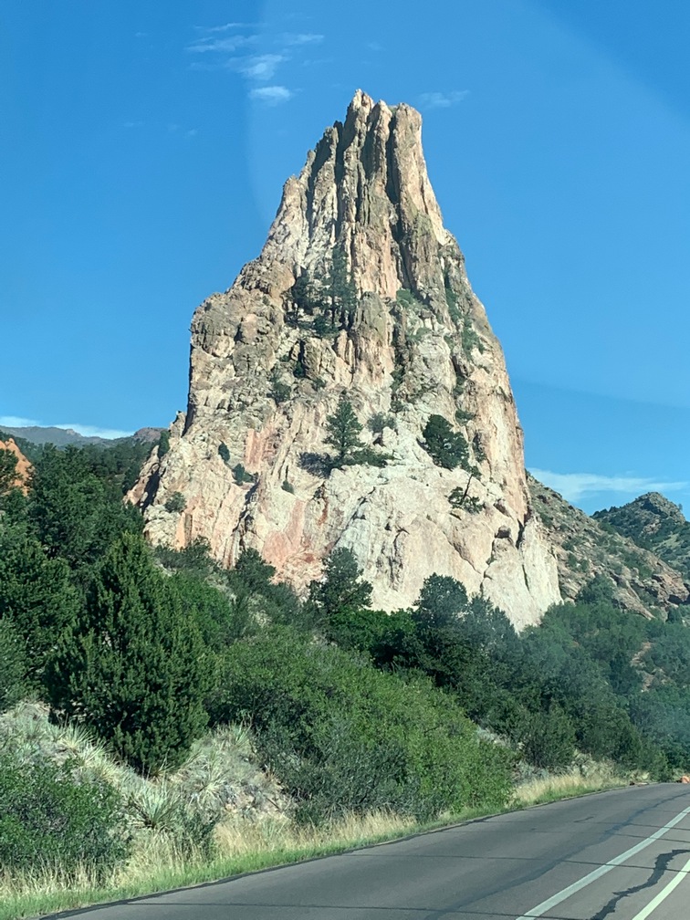
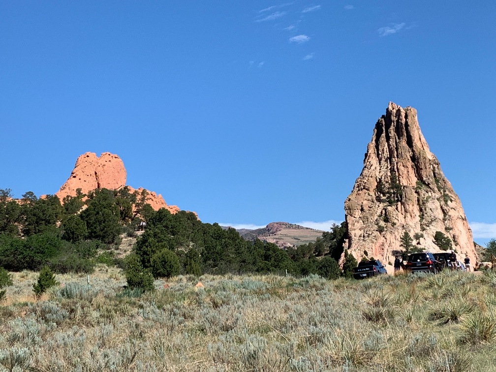
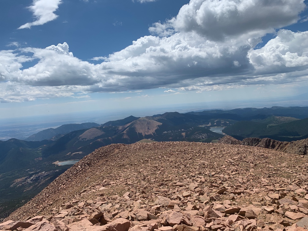
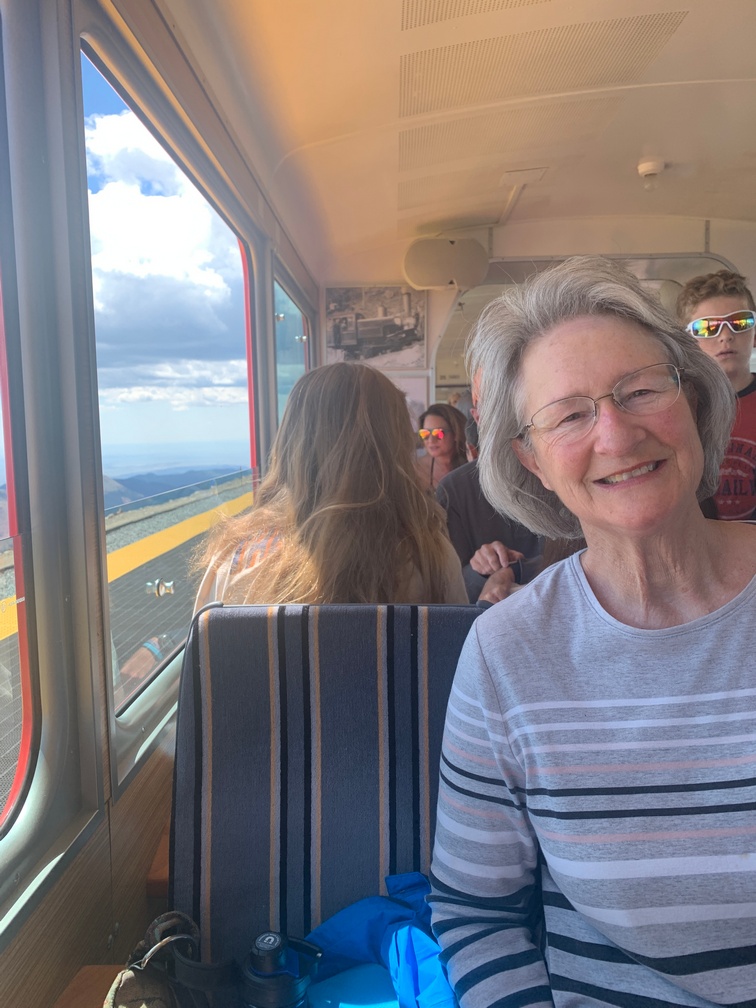
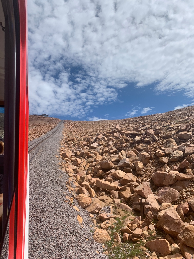
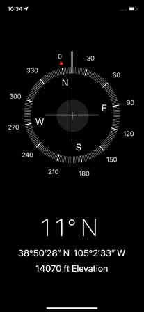
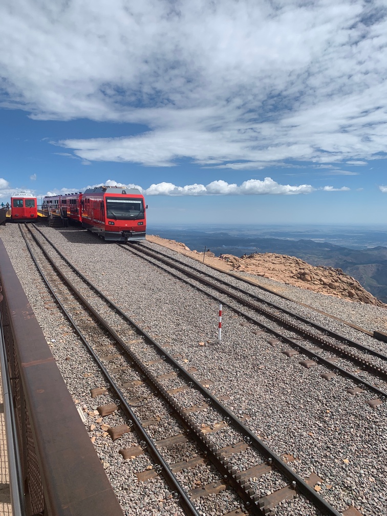
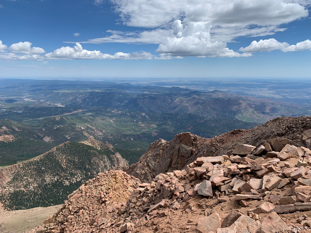
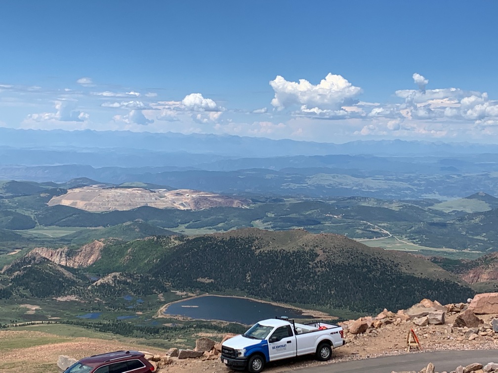
The next morning we were off to Colorado Springs.


July 10th thru the 13th.
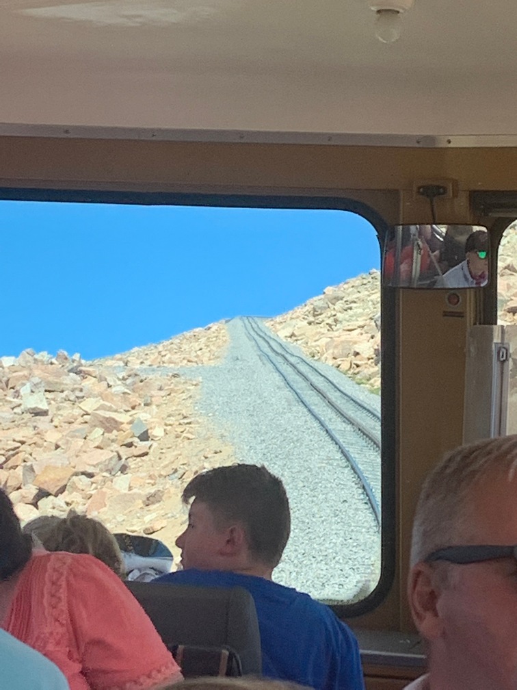


Telluride Colorado

The day after we went to Ouray, we drove over to Telluride for a day trip.  We got there fairly early and were able to find a parking space quickly.   We walked over to the gondola and looked for a gondola with paw prints on the side, which indicated we could bring Dusty on it.   Then we were off, climbing to 10k feet, where the car stopped and then proceeded to head downward to Mountain Village.   While it was stopped for a few seconds, we saw a great poster on the wall of 5 Labrador Retrievers in a gondola with goggles and headgear on.  Very cute!  Kathy didn’t buy the coffee mug of this picture while on top, so she had to find the studio in town to get it when she changed her mind!!

We arrived at the village a few minutes later.   By this time we were looking for breakfast or lunch and settled for brunch in a very nice outdoor restaurant.  Afterward we wandered around the village for a little while and then boarded another pawed gondola for the ride back down to Telluride.   Once there we walked over to a farmers market that was taking up a side street going up the hill.  The farmers markets in Colorado do have some veggies along with the other stuff.

Overall Telluride was a nice small town, Mountain Village was more of an upscale destination with the requisite prices to go along with that.  I personally liked Ouray more, and would skip Telluride, unless you want to take the lifts up for mountain biking.  (or skiing in the winter) .

June 24th