We didn’t get on the road till after 1 pm on Thursday afternoon. It was turning out to be one of the warmest days since we left San Diego over a month ago. We headed west on the 101. Yes, it’s 101 west up here where it makes a big loop around the Olympic Peninsula and reconnects back to itself down near Olympia, WA. We are still wondering how we missed the other 101 as we must have driven right past it on our way north on the 101. Kathy was very curious what it would have been called there, also 101 West?
Anyway, we went searching for Salt Creek Park and Tongue Point that juts out into the Strait of Juan de Fuca. Not long after leaving the park, which is buried in the woods, we came around a sharp corner and a small deer was slowly walking across the road. I had to slam on my brakes, and the deer wasn’t fazed. It just kept slowly walking till just before the guard rail where it bounded over it. Unfortunately, it looked like a steep drop on the other side. Kathy was upset at me for almost hitting it and causing it to jump into the abyss. It didn’t even seem like it noticed us to me.
After about an hour’s drive, we found a small sign for the park campground. I assumed we still needed to drive further along the road to find the point, so I kept driving. Within a couple of minutes we were 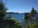 down at a large crescent-shaped beach with actual waves. We were at least 30 miles from the ocean at that point, so seeing what looked like ocean waves was a surprise. There was this nice looking campground on the other side of the road from the beach and we saw a few folks crossing the road to get to it.
We kept driving and the road kept getting closer and closer to the water until the road started to climb a cliff along it and then turned in toward the highway, all the time getting narrower. It wasn’t wide to begin with and was just a lane wide when I decided to pull into a dirt road to check the map. I noticed that we should have turned off at the park sign, so we turned around and headed back to it, passing the beautiful beach and wondering how cold that water was in the middle of July.
Turns out that the park was bought from the military after it was decommissioned due to not needing 16″ guns to guard the entrance to the Puget Sound anymore. 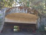 They removed the guns but left the bunkers. They reminded me of the gun emplacements I saw in
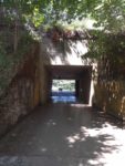
 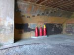 Normandy many years ago. After driving thru both bunkers, we headed over to check out the campground in the park. It
  was quite nice, but was raised up from the beach below at least 50 – 60 feet, and the edge of the campground was eroding away with just orange barrels and netting to keep you from falling down it.
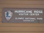 While there, I programmed Hurricane Ridge into the GPS and we started out to find it while heading back toward our home base for the week here. There was a lot of red on the map, and we figured out quickly what it was when we arrived at the beginning of the road that goes to the top: road construction and lots of it, probably 10 miles of the 19 miles to the top. That was a long, slow trip up the mountain, but worth the wait as at the top it felt like you should be singing Edelweiss in the Sound of Music. The scenery was spectacular! This could have been the place they filmed the mountaintop scene. Huge meadows and stunning views in all directions from a short hike to the overlook at the top.
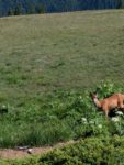 Lots of deer up there too. Dusty would have been in heaven if we would just let him run free! They didn’t appear to notice the visitors and would walk right past you as if you didn’t exist. We
 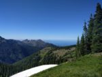 snapped a lot of pictures up there! It was just such a stunning vista with all the mountaintops ringing the area; and if you glanced north, the view of the strait and Vancouver Island in Canada was right there too.
To think I really wanted to go to the rain forest, but the drive there and back was over 6 hours. Way too much time in a car.
 We stayed up at the top so long that the road crew was all packed up on the way down, so we made it down in record time. On the way home, we decided to find another Mexican restaurant and we found one in Sequim with a large patio and pretty good food for being so far from Mexico.
It was probably a 30-minute drive back home from Sequim. When we got back, a neighbor came over while I was still gathering stuff from inside the car and said he needed to apologize to me. I asked what for. Turns out earlier in the morning I had asked why he had a small plastic step outside his coach where his automatic steps should be. He mentioned they had stopped working recently. I had asked if he had checked the magnetic sensors that are there right inside the door, and he said he had. Turns out he hadn’t and it got him thinking. Later he looked at them and they were not mounted back correctly after having someone install new carpet in his coach. I can now see he has moved that plastic step aside and the steps are deployed!
On Saturday I got a text from Verizon that I had used $50 of International Roaming already. I had to call them and it turns out while we were at Tongue Point my hotspot latched on to a Canadian cell tower. I told them I wasn’t in Canada and asked them if they could turn off International Roaming. They did and credited the $50 charges too. Turns out its $2 per megabyte for international roaming data. Ouch!
