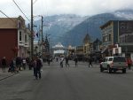
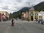
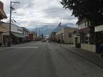
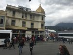
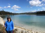
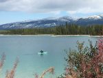
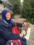
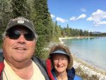
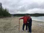
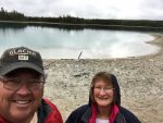
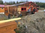
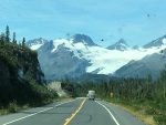
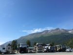
Heading to Dawson City, home of the Klondike Gold Rush

We left Whitehorse early Thursday morning and filled up with diesel.   I am sure glad I topped off in Ft. Nelson as I would have been shy about 10 gallons to make it all the way to Whitehorse.

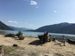
We drove north on the Klondike Highway, hoping to get a campsite at the Pelly River Crossing Campground.   It was a day prior to a 4-day holiday weekend for Canada, so we were keeping our fingers crossed we’d find a site there.    There are very few campgrounds on the Klondike Highway, especially when you want to stop halfway to Dawson,  actually just the one.

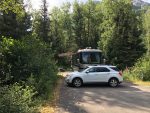
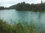
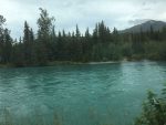
We arrived at the campground around 2 pm that Thursday afternoon and it was empty, completely empty.  We found an ideal pull-thru site and made our camp facing the Pelly River, which is a fairly wide river moving pretty quickly.    By the evening about 6 more of the sites were occupied.


All the campgrounds near Dawson were booked for the Summer Solstice party, we were not able to reserve a spot until Saturday night; so we stayed two nights at the free campground on the river!   There were a lot of trees, so my solar struggled (I struggled) to charge the batteries.  I did have to run the generator a bit that first evening and less the next evening as I was able to gather a bit more sun by moving the solar suitcase quite often to keep it out of the shade.
I think the most amazing thing about Pelly Crossing was how good the cell coverage was.  I had 4 bars of LTE on both the Cricket phones and the Google Fi hotspot.   There had been no service most of the way there and a lot of the way to Dawson City too.

We walked over to the only establishment near the campground.  It was a gas station and small general store.  I think it might have been the post office too.  They had quite a bit of groceries and every type of supplies you could need for such a small place and being so far from anywhere.

The following day we just relaxed and watched the river slide by in silence.   The only thing breaking the silence was an occasional truck that went over the bridge on the Klondike Highway about a quarter mile from our campsite.   Well, I got to relax in between moving the solar suitcase back into the sun, that is.

Saturday morning we were in no hurry to leave as we had reservations for that night in Dawson.    We left around 11 am, way after all the others (maybe 7 campers) had left the campground.
The Klondike Hwy became a lot more rough and potholed right after we crossed the bridge.  There were lots of orange flags marking even rougher pavement the rest of the ride that day, and I spent most of the time scanning ahead for those flags and avoiding all the pot holes in the road, often having to drive on the other side of the road for long stretches to avoid the worst parts.   But, thankfully, there have been no gravel sections since the ride from Watson Lake to Teslin Lake last week.

We arrived in Dawson City, to the Bonanza Gold RV Park, early in the afternoon.   We drove around the area and looked at all the other campgrounds.  This one was much nicer than the rest of them.   The worst looking place was the campground in the middle of Dawson,  no trees and I have never seen RV’s so close together in the dirt lot.   I had thought the Downtown RV park in Watson Lake was pretty tight, but now I know better.  That place was spacious.    Don’t get me wrong, Bonanza is not large by any means, but we have some trees between us and the next RV,  I think our slides are about 10′ apart.   In Watson they were maybe 4′ apart.   But the Dawson sites had maybe a foot between RVs.  We drove by one that I wasn’t sure they could open their door to get out.  Now that is way too close!!


Whitehorse, the Wilderness City.

After I installed the rock screen and left Teslin Lake for Whitehorse, we didn’t encounter any more gravel on the roadway.   And just past the highway 8 turnoff, the roadway changed to a very smooth asphalt, something we hadn’t experienced since the Ice Fields Parkway.  That was an incredibly smooth roadway.

Once we checked in at the Hi Country Campground and deployed the coach, I had to unhook the car which required me detaching the rock screen.   With that done, I crawled under the car to figure out what I could do to make that an easier process.  I found a couple of holes that I could mount four inch- long eye bolts to hook the bungee cords to the front of the car to keep tension on the screen while we drove.

We happened to get a site at Hi Country practically next to Larry and Sue that we had met in Teslin Lake.   They had mentioned one of their favorite places to eat in Whitehorse while we were in Teslin Lake, so Kathy and I planned on having dinner there the night we arrived in Whitehorse.  To our surprise, they were also going that night, so we went together.   There was quite a line for Sunday evening after 7 pm, so we put in our names for the one-hour or so wait and the hostess mentioned a lounge a block or so down the street.  We headed there to be out of the cold.  It was a small hotel called the Westmark,  went inside and found four seats at the bar to chat while the wait passed.   After paying the bill, we walked back to the Yukon Rib and Salmon joint and had a really great dinner.   I had the Salmon and Ribs house special and it was delicious.   Afterward we went back to their coach to continue the conversation and libations.  Larry showed us how he had modified his kitchen pantry into a wine rack.  I had modified mine to carry more soup and taller bottles..   I bet if I liked wine, I would have done something similar to Larry and Sue’s pantry mod.  🙂

I was amazed how similar our coaches’ designs were, lots of incremental changes in the 5 years since ours was built,  but it still seemed so similar to my eye.  I think the last thing Kathy said that night as we left was she wants a new bus.  Apparently it’s time to start playing the lotto in earnest.

(I think he dreamed that last statement!)

Prior to dinner I drove into town to find a hardware store to gather the eye-bolts and required washers and nuts to hold them in place.  I also wanted to fill my growler with some Yukon Brewing ale.    If found the parts I needed, and as I pointed the car in the direction of the brewery, I realized I left my growler on the front seat of the RV.   Bummer.  Next time….   I got back and installed the eye bolts and now my rock screen is done!

The next day I had the growler in the car and stopped at the Yukon Brewery only to find out they didn’t have their signature brew on tap.  So I had to chose something similar, but in the end wasn’t anywhere near as good.  On the way back, I stopped at the only open Mexican takeout joint in town.   The Tacos and Burritos were very good.  Hard to imagine here,  thousands of miles from Mexico, someone can reproduce such good Mexican food.

The following day we played full-on tourist.  We visited the the Yukon Paddle Wheeler.   They explained that the predecessor to the one we toured was put in service in 1929 and ran into a rock and sank in 1936.  They had salvaged all but the hull from the previous sunken ship to create the new paddle wheeler in less than a year.   No small feat I would imagine.  Without it running the river, the town was probably dead in the water for any supplies so they had to get it done quickly.


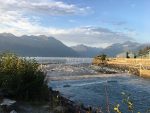
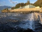
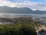
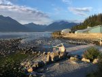
After we finished touring the ship, we headed over to the fish ladder.   The longest one in the world we were told.  It was pretty long, mostly made out of wood planks.  And it was leaking pretty good from the bottom just past the small building that housed the windows you can watch the fish thru.  But we never saw any fish as the salmon wouldn’t be up to that part of the river for another month or so.  Currently they were just entering the mouth of the Yukon River some 2,500 miles away in the Bering Sea.

After that we went to lunch at the only other Mexican place,  Sanchez Cantina.  The meal was really good.  If you ever get to Whitehorse YT and you like Mexican food, I highly recommend the Cantina.  That evening we joined Larry and Sue for another meal at the Klondike Rib and Salmon restaurant.  This time I had the Halibut Fish and Chips.  Wow is all I can say about that.  Best fish and chips I have ever had.  The halibut was exceptional!

The next day Larry and Sue were heading west toward Destruction Bay and the following morning we were heading north toward Dawson City and after that the Top O the World highway.    Lucky for us they shared their great itinerary written out in a spread sheet and I was able to use their choices for campgrounds to flesh out my itinerary as the cities were listed on mine, but I had not researched the actual best campgrounds in those cities yet.  I was doing it as needed.   Larry saved me a lot of time fleshing out what are probably the better choices in each of the cities as they had been to most of them already.    They planned their whole trip in advance of leaving.  It probably makes it a lot easier to do that when it’s not your first time there,  but at least now I know where I want to stay.  And if we are lucky, we will be able to get sites at those same campgrounds.   It looks like we will be a couple weeks behind them most of the time, so it looks unlikely we will run into them again on this trip, but you never know when traveling 🙂

That afternoon we headed out to find the suspension walking bridge over Miles Canyon.   It was a really cool place that the Yukon River gets channeled thru a very narrow canyon.   That must have been one thrilling ride in that old steamboat.

The bridge itself looked really sturdily built, but once you walked on it, that thought disappeared from your mind as it bounced and swayed around you.

That was a really beautiful afternoon.   Afterward we drove around and checked out easy in and out fueling stations for the RV to use Thursday morning on the way north toward Dawson City!

Entering the Yukon, Watson Lake and on to Teslin Lake.

We took off in the early morning from Muncho Lake to head for Watson Lake.   It was a very bumpy ride again.  The gravel sections are very long now and extremely dusty with my favorite washboard surface.   These guys really need to figure out why most highways are made from asphalt.   I know it must cost a lot more than dirt and gravel do, but it’s got to be way less labor and it would yield a nice, smooth driving surface immediately.

We arrived in Watson Lake around 1 pm and got a spot at the Downtown RV park, a basic gravel lot with water and 30 amp service, very closely spaced.  I think someone mentioned it looked like an RV sales lot in the webcam.

I am starting to understand that WiFi in campgrounds, even if advertised, isn’t useful at all, except for maybe a pop mailer.  Using web mail would be an exercise in futility.   And up here in the wilds, they use systems that give you 1/2 hour of internet (and they barely work, if at all).   Something I gleaned last night from folks we went to dinner with is all the Canadian Visitor Centers have free WiFi and they considered it fast.   I will have to check that out when I run out of high speed data again.  Thankfully my monthly allotment refreshed the morning we left Watson Lake.

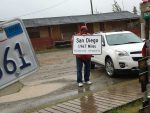
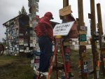
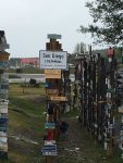
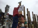
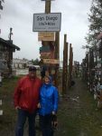
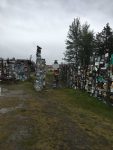
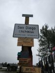
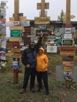
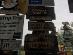
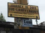
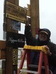
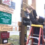
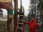
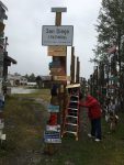
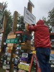
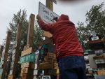
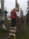
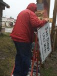
Now on to the better stuff.   Watson Lake is known for the Sign Forest.   Prior to being here and walking thru it, I thought it would be some kitchy tourist place, but was in awe when I got there.   Pictures don’t really show the scope of it.  It’s really large and the visitor guide says there are 76,000 signs in it.  I believe it.   It is, for lack of a better term, overwhelming.    I never thought I wanted to put up a sign, but while we are traveling, we will be looking for the right material to make one.  It turns out that our route home from Alaska is the Cassiar Highway, and its junction with the Alcan is 14 km from Watson Lake.

BTW,  if you make a sign, it needs to have at least the town you are from and the mileage to it from Watson Lake.   Also, you MUST bring a tall ladder as all the open spots on the poles to hang them are at least 10 feet off the ground.   Screws will probably hold better than nails.  If you make it from wood, cover it with paint and polyurethane to make it last.   The older wooden ones that are just bare wood are getting difficult to read.

We stayed in Watson Lake for one night.   There is not much else to see there.  Watson Lake itself was not easy to get to.  Seems everything around it was privately owned so we never got to see the actual lake.  There are two other lakes closer to town called Wye Lake #1 and #2.  They weren’t much to look at.

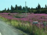
As you drive thru Canada, you will notice the pretty yellow flowers along the roadside in most areas.   What you might not notice unless you stop and look is they are dandelions.   Very long-stemmed ones,  not like what grows in my backyard.  I am starting to wonder if they are the state\national flower.  It sort of looks like they were planted there.   They remind me of the poppies alongside the mountain roads in San Diego.

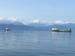
The following morning we drove off to reach our next stopping point,  Teslin Lake.   The road was even rougher and dustier than the drive to Watson Lake.   We camped at the Yukon Restaurant and Motel.   The RV sites are right on the lake behind the buildings and just next to that very long metal-grate bridge you can see in the pictures.  The only real noise there were the vehicles going over the metal grates on the long bridge.  Kathy likened it to the sound of a swarm of bees.  That was exactly what it sounded like to me too! 

We met some great folks at that campground and Dusty met his new best friend named Camper.  She was rarely on leash and she scampered over to see Dusty whenever he was out and about.  We had done a few single night stops, so we decided to stay here for two nights.  Glad we did as that gave me time to finish my rock screen.   Unfortunately I seem to have left a crucial part on my desk at home, so I had to purchase a few Christmas-colored bungee cords at the general store in Teslin.   I should be able to cut those bungees so I can use their hook ends on my bulk bungee cord so the whole screen is black.

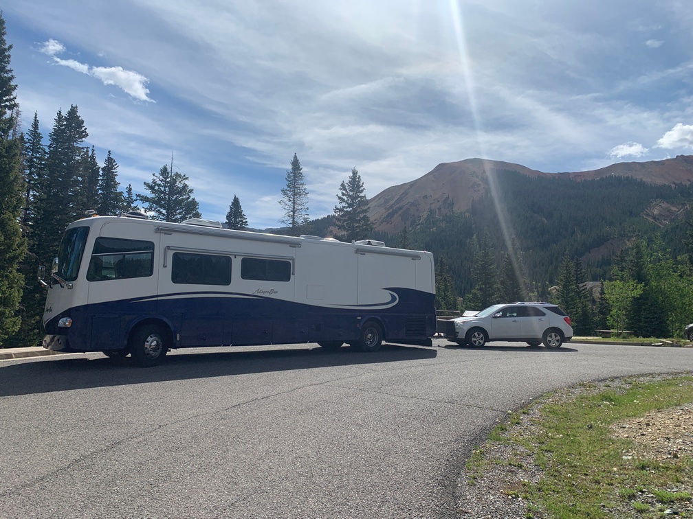
We drove off with the new screen in place and after about 50 miles took this picture while parked in a turnout to see if it had self-destructed or blown off.  Looked good.  Now to go find that gravel and give it a real test.


The Alcan to Muncho Lake

We got up early Wednesday morning so we might have a chance at getting a lakefront spot in Muncho Lake’s MacDonald Campground.  It’s a first-come, first-served provincial park on the lake and it will be another night of boondocking. We ate a quick breakfast and packed up the coach for travel. Then we headed over to the fueling station I had scoped out the day prior to top off the tank for the way back yonder stretch of the trip.
That done and the car attached, we set out for Muncho Lake. The first hour was just beautiful scenery and a few cars and other RV’s, but after that we started climbing back into the mountains. The Northern Rockies is what the map called them.
The road got very narrow and bumpy. A lot of dodging small potholes was on the menu for the day. Then we came up on “loose gravel” signs, and right after, the loose gravel. We slowed down to below 30 mph in an attempt to kick up fewer of those rocks, but a truck came barreling down the other way and sprayed us with them. Three direct hits on the windshield. Luckily no cracks so far, but that experience suggested that pulling way over to the right when they were coming was not going to help, as I had done that.

A little further up the “gravel” road I saw 6 fast-moving trucks coming down the grade about a 1/2 mile away. Then I spotted a few-hundred meter stretch of the road without gravel and stopped the RV on that to let them barrel on past. That worked! Not a rock hit the RV. Luckily for me there was no one behind me so stopping in the middle of the highway was ok this time.
Once they went by, we proceeded and in less than a mile we saw the line of trucks, cars and RV’s just getting started behind a pilot car to lead us thru the ongoing construction. That was a dusty few miles! But the crazy part was what it appeared they were paving the highway with. It literally looked like brown dirt with gravel mixed in. And they were laying it directly on the old asphalt, no liquid asphalt was sprayed on first to “glue” it to the roadway.

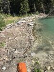
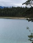
It took a good hour to get thru this construction zone and then back up to the 80 Kph speeds again. Lots more windy, bumpy mountain road to go! As we approached Muncho Lake, we came across a dozen or so Stone Sheep on the sides and in the middle of the roadway. After a bit, they let us pass and we arrived at the MacDonald Campground and turned down its dirt roadway. Since we had got on the road early that morning, we found there were many open campsites. We chose one and I pulled straight in so we could look out the windshield at the lake. It’s too bad there is absolutely no connectivity here so the windshield camera is not online for this as it’s gorgeous!  It is a beautiful and level lakefront spot with a big picnic table. This is a little bit O heaven. Really quiet and peaceful place. And only 14 other campsites here and a boat launch. We saw a couple kayakers and a few small fishing boats on the pretty, light blue lake with all the tall mountains ringing it.
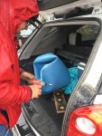
I wanted to clean off the bugs and maybe wash off some of the dust, so I went in search of a water spigot to see if I could get away with not using the water we brought with us and I found an old hand crank well pump. It worked, and it was a workout to get a pail of water out of it. I pumped 3 more bucketfuls that evening and vowed to bring my WD40 with me if I needed to go back again. I didn’t have any grease, which is what it needed, but I figure the WD would work for a few days…
I am writing this the morning we are leaving for Watson Lake in a text editor as we have no cell or internet service here and will paste it into a post when we get somewhere with service.   Waking up this morning with the beautiful lake out the windshield was an awe-inspiring moment.

During our walks last night, I saw what must have been the original design of a speed bump. I had never really thought where the idea came from, but this one was a round log set into the roadway. I’m guessing someone thought of this when cars were first introduced to slow them down a bit. I guess it would have had the same effect on wagons too. I remember reading about the Civil War and corderoying the roadway with logs to pull the cannons thru muddy roads. That must have been some ride if you were in a wagon.

Anyway, we are pushing on to Watson Lake this morning and plan on walking thru the Signpost Forest. I am assuming there is a lake there but have not seen anything written about that. I am guessing we will be staying in what will look like a gravel parking lot there. The opposite of today’s campsite.

The starting point of the ALCAN highway to Fort Nelson

We got out of the campground before 9 am to fill the fuel tank with  $109.9 per liter diesel, which translates to about $3.15 US.  I believe the cheapest fuel we found in the States on the way was $3.12, so Costco Canada has its act together.

We stopped and took a few pics in Dawson Creek, as we didn’t have anything listed to see there, so we got on the ALCAN and headed toward Alaska!   We thought we would stay at Charlie Lake Provincial Park just north of Fort St. John,  if there was availability when we arrived.  There was,  so that evening we enjoyed a very wooded British Columbia Provincial park.   There were no hookups in the campground.  We did see a few strategically placed water spigots on the park road so you would be able to fill your tanks if needed, and there was a dump-station there too.


It was a no-hookup site and heavily forested so the solar wasn’t going to do much for us.   It was going to be a live off the batteries and charge them as we drove the next morning to Fort Nelson, about a 220-mile drive.

I had a little time after the rain stopped to get my rock guard front bar mounted on the receiver on the back of the coach that evening.

We shoved off the next morning with the hopes of staying in Fort Nelson that night.   The road was real smooth, similar to all the other roads we had been on in Canada till we hit Kilometer Marker (KM) 170.   After that the road jostled us the rest of the way to Fort Nelson.   Also, not long after KM 170, we saw a bear run across the road way in front of us.  The next couple hundred miles had us see 4 more bears alongside the road.  Other than that there wasn’t anything else to see except the scenery.   We made it into Fort Nelson a little after 1 pm.  Turns out we were back in Pacific Time when we entered BC, so it was earlier than expected.

I had called Triple G Hideaway Campground from Charlie Lake that morning and they said they would fit us in, no problem.   When we arrived, the place was almost empty.  By 9 pm it was almost full.  Nice little park right on the Alcan.  Luckily we were placed 3 rows from the rear and couldn’t hear any road noise that night.   When we walked over to the town’s small museum, the front rows of sites had plenty of road noise.  But I bet traffic isn’t probably much of an issue once it gets dark.   Sunrise it 4:01 am and sunset is 10:20, over 18 hours of sunlight.  Less than 6 hours of night time here.

We stayed at the 3 G for a couple of nights.  Finding these campgrounds with good WiFi in what is essentially the wilderness is pretty nice.  Living on 256 Kbps is more like dial-up than you think.  Even though the fastest dial-up I remember was 56 Kbps, the websites you looked at had a minuscule amount of graphics back then and practically no one had a digital camera .  If they did, the photos were 100 kilobytes,  not 4 megabytes each.   And no one pulled down 1 Gigabyte video files so their significant other could watch her soap opera.

I checked out the 4 local fuel stations to determine the easiest egress to top off before we really get into the back yonder and fuel gets close to double the cost till you get to Whitehorse in the Yukon.   We might be able to make it to Whitehorse with the fuel we have but that would be cutting it really close on range.  And I heard from a local that used to truck fuel to Whitehorse, there are 7 large grades between here and Whitehorse and about 600 miles of road to get there.

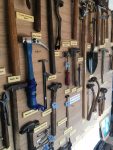
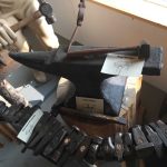
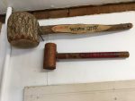
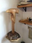
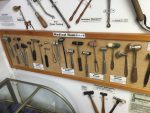
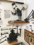
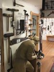
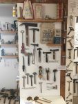
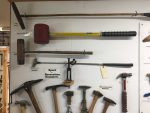
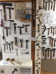
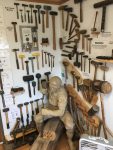
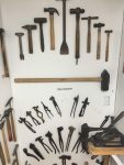
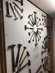
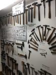
Yesterday afternoon we walked over to the Fort Nelson Heritage Museum.   Quite a bit of stuff to look at, from old cars and machinery to huge generators that used to power the town.   It was quite a collection, even old communication equipment.  I really like what appeared to be a telephone test rig that looked like a piece of furniture.   I think it was $7 C.  It was a blast from the past!   Glad we walked over there.  If you are ever in Fort Nelson looking for something to do,  you could spend hours looking at things.


A few days in Grande Prairie, Canada

Driving from Grande Cache to Grande Prairie was an easy drive.  We passed lots of oil drilling or fracking sites, I mean a lot of them.   And all the traffic on the road seemed to be trucks servicing all the sites.   It again rained most of the day; and when we pulled into the Grande Prairie Rotary Campground, it was still raining.  We got checked in and drove to our site, which was a pull-in and fronted on the Bear River.   We had lots of trees covering most of the view, as you could see out the windshield’s webcam; but it was fairly level and the utilities were on the correct side for pulling in forward into the site.

We got all set up and I headed out for a growler fill at Grain Bin Brewery and then over to Costco to check out the access for diesel when we leave.  $109.9 per liter is the lowest I see anywhere in Canada today.   Works out to roughly $3.20 US per gallon.   Anyway, I filled up the toad while reconnoitering.

I noticed an Elks Lodge on the map and I was wondering about that as I thought they were only in the US.   More on that later.

A few days back we had our propane leak detector go on the fritz, so I had to disconnect it.  While here in GP, I scoped out an RV parts place called McGregors.  They actually had the exact one I needed and of course it was exactly double the cost for the same model online.  As we are traveling, buying it online would be problematic due to not having exact set plans for where we planned to be.   I picked up the expensive detector and hooked it up this morning.   The light is green, supposed to mean it’s not detecting any leaking propane.   Propane smell is pretty distinctive, so I am not sure why I really need one.

While we are on the road, we are always looking for good Mexican food, and to find one of the better taco shops we’ve tasted here in GP was nothing short of amazing.   El Norteno was the bomb!  And so was its sister taco stand, El Sureno’s.   They made their own corn tortillas right in front of you and added great ingredients.     Both places were located in food courts, one in a sports complex / leisure center and the other inside the Farmers Market.   Very different locations, but well worth the visit if you love great tacos!   We think we are experts due to living 20 miles north of Tijuana.

I made a Costco supply run on Friday and a Safeway supply run on Saturday afternoon.  We are now stocked up for hitting the actual Alaska-Canada Highway tomorrow.   We assume big grocery stores may be few and far between for the next few weeks.

After stowing all the supplies, I decided to head over to the Elks Lodge to see what was happening there.   We have stayed at a few lodges on our trek, so I was curious about there being one in Canada.   Turns out it’s not part of the American organization and there isn’t a social club inside.   So afterward I went on the hunt for a place to go to dinner.

We found The Keg Steakhouse, which was outstanding.  I didn’t know it was a chain when we arrived, but the hostess told us a little about the place.   We ordered their specialty, the prime rib, which was pretty good.   To our surprise, prior to the entree, the manager stopped by and delivered a complimentary shrimp cocktail.   It had the largest shrimp I’d seen since visiting Sydney back in the 1980’s.  She told us that since we were first-timers, we received the shrimp compliments of the Keg.   The meal was excellent.  We will be back… Too bad there isn’t one in California.

We are all filled up with water, will dump the tanks in the morning and head on over to Costco to fill up with diesel fuel.   We last filled in Shelby, Montana, prior to hitting the Canadian Border.

Drive to Grande Cache then on to Grande Prairie

We left Jasper around 10 am for a leisurely drive to the Municipal Campground in Grande Cache.   Highway 16 east was a pretty nice ride, driving alongside a river most of the way to our turnoff on Highway 40 north.

After the turn onto 40, the drive was no longer leisurely as I was dodging potholes for the first 10 miles.  After that the road got a lot better until the construction areas began.   I think they are in the process of widening that road and it appears the first thing they do is clear-cut the trees and bring in logging trucks to haul them away.

I noticed something odd whilst driving that road.  For many miles there was what looked like orange Inter-duct lying on the ground close to the edge of the trees.   Inter-duct is what fiber is normally run thru.   I am pretty sure that is what was inside it because every mile or so there was a utility box it connected to.   This went on for maybe 50-70 miles.   I guess they are running fiber to the towns along that highway.  The odd part is I have never seen it just laid on the ground.  Back home it’s usually buried.  I guess they were just in a hurry and later they will get around to burying it.

There were a bunch of construction zones along the way, and they slow you down to 50 kph, which is about 30 mph, a very slow speed, especially when there is no construction in sight for miles before and after the workers.   One of the work zones was very interesting.   They were piling dirt/gravel down the middle of this two-lane highway and ahead about a half mile away was a line of dump trucks in the right lane waiting to drop more.  I assumed I was to wait for the cars in the southbound lane to clear and then take that side of the road, but I was waved to go and take the right lane.  It was a mud bath for the RV and especially for Kathy’s car being pulled behind.

It wasn’t far from the mud bath till we arrived in Grande Cache.  Nice small town surrounded by mountains.   We located the campground and backed into our site, but the only way I could level the coach was with the front tires about a foot off the ground.   We moved over a couple spots to a much more level spot and notified the office.

One thing that pisses me off is a place that advertises they have WiFi only to get there and it doesn’t work at the campsites.   This place wrote on the paperwork that it only works in sites near the office… And there weren’t any chairs in the office if someone did need to use it there.  We survived with our 25 KB hotspot.  (We ran out of high-speed data in Canada about the 3rd day after crossing the border. )  Can’t wait till we can get to Alaska where our unlimited hotspots will work again!

Here is Dusty sleeping during our drive to Grande Cache


Jasper National Park

The first thing we noticed in Jasper was the vast swaths of dead pine trees on the mountainsides.   We are boondocking at a Parks Canada Overflow campground.  No services except pit toilets and fairly level gravel back-in lots with picnic tables.   It’s been raining off and on quite a bit, so the solar had been slow to charge the batteries.   The first afternoon there, we drove into the town and found the visitor center for a map of places to see.   It’s a nice small town built on the side of a small hill with a railroad station and track bordering the southern edge, and just south of that is Highway 16.   We drove up to Pyramid Lake,  not sure why it’s called that as it’s not shaped like one.   After having a snack there for lunch, we drove back down to the town where I thought we would walk around; but the rain really started coming down hard, so that was sort of a bust.   So we headed down the parkway to Athabasca Falls by way of 93A, which is the old highway.

We drove probably 30 km to the falls, and they were utterly spectacular!   There was so much water trying to get thru, it was like watching chaos, or what one would imagine chaos to look like!   The pictures don’t do it justice.  I tried to take some short videos of it.  I will attempt to post them here.   It started raining on us again, so we headed back toward the car and drove north back to Jasper.

Athabasca Falls

We ended up driving back to the campground around 5 pm; and when I got there, I noticed the batteries were only back to 88% of full.   I brought out the solar suitcase I built and hooked it up to see if we could get them back to at least 95% before the sun went behind the mountains.    Maybe 45 minutes after I set them up, it got windy and started to rain hard.  I figured we were done with the battery charging; but when I went over to the door to make sure the panel tie-downs were working, I noticed a small patch of blue sky over the mountaintop.   To my surprise, the rain stopped a few minutes later and the sun again started shining very bright.    A couple hours later our batteries were back to 100%.    That was way better than expected.   After the sun went behind the mountain to our west, I went outside and stored the suitcase back on the shelf I built just for them in the basement.

It’s been really cold since we left Lake Louise a couple days ago, and as I mentioned, this campground only allows two-day stays.  We are leaving in the morning to drive up to Grande Cache.


Columbia Ice Fields

Driving up the Ice Fields Parkway was another incredible scenic journey.  The Canadian Rockies shouldn’t be missed.   The parkway itself has been one of the smoothest roads I’ve ever been on.   Smooth is nice when you are driving your house on it.   There was only one large grade on it and it was maybe 20 km prior to our destination that day,  the Discovery Center at the Columbia Ice Fields.   We had no cell service the whole way up the road to the ice field and beyond.  We got that back once we were about 5 miles from the town of Jasper at the other end of the parkway.

I wanted to take one of those monster trucks out onto the glacier.   We got into the RV parking lot around 1 pm,  and after a struggle to level the coach, I hiked in the freezing wind over to the center to purchase tickets for the excursion.   They were booked up till 3:30, so I bought tickets for the 3:45 tour.   $100 Canadian each.   I went back to the coach for some lunch and a bit O blogging. (offline, no internet at all except in the building some 500 meters away, and I forgot to ask for the password)

The RV parking lot allows for overnight camping with a fee you put into a slot in a pole near the top of the lot. The parking is no where near level, so be prepared for major leveling process to get level as this is an “absorption fridge killer” slope.   The wind on that lot was probably gusting at 40 mph.   We had planned to camp overnight there, but between the precarious footings and the wind gusts, I was doubting I really wanted to stay the night there.

I was amazed at the output of my solar panel while parked there.  I guess it was so cold and the lack of pollution in the air and possibly the altitude had me producing 575 watts from 640 watts of panels.   I think I was pretty amazed at 525 watts last fall, but 50 more watts of power in the real world just amazes me.

We headed up the hill around 3 pm for our tour that started boarding at 3:30. We had plenty of time to get WiFi connected and sync up our email and texts during the wait.   Kathy got to peruse the gift shop while I called around to find a campsite for the night.   I found no sure things.  More on that later.

Our boarding time arrived and we got on a tour bus that drives you the kilometer or so over to the ice crawlers.  It was a quick 4 minutes and the bus driver said it would be the best 4 minutes of our lives.  It really didn’t live up to that,  but the ice crawlers sure did!

We got dropped off in front of our crawler and Shane, our driver for the tour, introduced himself.  He was a pretty funny guy, but I think a lot of the other tourists didn’t always get his jokes.  He was from Nova Scotia, so his humor needed a few seconds to sink in.

The crawler is a 30-ton beast with 6-wheel drive and large tractor looking tires.   It is truly a crawler, as I think he said the top speed was 10 mph.   We started climbing right out of the lot, and then we stopped at the top of a really steep hill.  From our vantage point, it looked like a cliff.   There was a tension in the air as he stopped to engage the 6-wheel drive.   Then we started down the 32-degree grade.   I’ve been on steep grades back in my dirt bike days, but this was over the top when inside what is really a large 56-seat bus!

After getting to the bottom (probably took 2 minutes to get to the bottom) we drove thru a large tire-washing puddle.   They don’t want to bring muddy tires onto the glacier, so they divert some of the glacier melt onto the road to clean the tires.   After about 20 minutes in the crawler, we were at the destination on the Athabasca Glacier.  It was really cold and windy up there.   Since we had never been on a glacier before, it was pretty cool.  It really wasn’t that slippery either.  So I went around taking pics and got Shane to take a few of us.   You can see him in one of the selfie shots.


We stayed on the Glacier for 30 minutes, and just prior to leaving, it started to snow on us.   It’s June, right?   That meant it got even colder, so I skedaddled back in the crawler quickly.  One poor guy was really unprepared and was wearing sandals and a sweatshirt.  The temp was in the 20s with the wind chill factor!

When we got back to the transfer point, we got on the shuttle bus that was to take us to the glass overlook a few miles up the highway.   We, and most others, chose not to get off the shuttle bus in the blustery weather at the glass walkway.   Instead, we took it back to the center and walked back to the RV, closed it back up, and headed on down the road to find a less steep and windy place to sleep.

We drove toward Jasper and tried Wapiti Campground, but they were full.  It was quite a chore to get back out of that campground.   Thankfully that ranger in the kiosk told us about Snare River Campground overflow.   We programmed that in our GPS and took off to find that.   By now it was 8 pm and as we got to the turnoff, I stopped in the left-turn lane to see a train trestle without any height sign.   I didn’t want to temp fate, and we sat there for a few minutes and a car came thru it, so we could tell it was pretty tall.   We drove under it very slowly in case we were mistaken.

About 5 km down that small road was the Snaring River Campground and we turned in.   That wasn’t where the overflow was and I had to disconnect the car to be able to get out of that campground.   This was getting to be a long day!   Turns out the overflow for Snaring River was about 300 meters down the road on the other side of the Snaring River.    The bridge we needed to cross didn’t look so good.   It appeared to be covered in asphalt over a wooden deck,  and lots of the asphalt was missing, showing the splintered and possibly rotten wood underneath.    We got across.  (I think Kathy waited till I was all the way across before she drove the car over, as she didn’t feel the need to plummet into the fast moving and probably very cold water.)

We drove into the campground, paid our $15 and drove thru this huge campground with 3 other campers in it.  The place had 300+ sites, all with compacted gravel parking and each had a picnic table.  There were no other hookups.   Later we found a few large water tanks, but they appeared to be gravity fed, so we weren’t going to fill the RV tanks with that.

An elk grazed thru the sites in the evenings.. We got in there close to 9 pm.   The place only allows two-day stays, which I had never experienced before, especially considering there were at least 298 unoccupied sites available.   Of course, there was a train track a few hundred feet from us, but no train whistles were to be heard.   No grade crossing within ear shot I guess.


Lake Louise

As I mentioned in the prior post, we arrived in Lake Louise without reservations.    As we drove toward the first campground around 11 am, the sign said,  “Campground full.”   But it was the type of sign someone would need to physically walk to and change the placard.   I was hoping they were too lazy or it was always left that way.  Turns out my hopes came true.  They had lots of open sites.   People were coming in till after 8 pm that evening and I don’t think it ever actually filled up.

The gal at the check-in kiosk mentioned there has been a grizzly in the camp often this year with a few cubs, but that she was “friendly.”   Whatever that means?   We never saw them for my disappointment, and to Kathy’s delight.

Now, the reason this campground probably isn’t top on anyone’s list is the trains!   They seem to come by every hour or just slightly more often.   The westbound trains blew their horns just a moment before passing behind our coach.  The tracks were about 150′ from the back of us.   The eastbound trains blew their horns on the other side of the grade crossing, so it was much further away and almost pleasant.

We weren’t really sure we wanted to stay the two days I signed up for once we experienced the trains, so we decided to see as much as we could that afternoon just in case.

When we got to Lake Louise, the parking lots by the lake were full; so we waited till around 5 pm to take the drive up so we didn’t have to take the shuttle bus.   There was a steady stream of cars coming down the mountain as we drove up to the lake. There was no parking issue when we arrived, so we walked over to the lake, and it was surprising how much ice was still on the lake.  There were also quite a few tall snow banks scattered about for June 1st.   The elevation was less than 6,000′, so that latitude makes a big difference.   I know there isn’t snow at 6,000′ in San Diego now.

We walked around for a little bit, but I didn’t head out the path along the lake toward the mountain that evening.  Kathy walked down a ways and reported that the water color was magnificently teal after you got past the area with the slush and ice.   We headed back to the coach to listen for more trains that evening. They didn’t disappoint us; there were plenty of them!  The next morning I realized once my head hit the pillow, I didn’t hear one of them.   I’m pretty sure they didn’t stop running so we could sleep.

We got an early start this morning and headed up toward Lake Moraine, but its lot was already closed and they wouldn’t let us make the turn toward it; so we headed up the hill, back to Lake Louise.   Parking was a bit of an issue, so I let  Kathy off at the Chateau to look around inside, and Dusty and I went off to find a parking spot.  It took a bit of circling, but I finally got one and we headed off for a walk around the lake.   It was a gorgeous day to walk out to the other end of the lake.  I was even more surprised today as the ice on the lake was about 1/2 the size it had been last night.   Probably due to the different angle of the light today, the color of the lake was an incredible teal blue.   It got even prettier the further out on the path we walked.   I’m not sure how far the walk was, but it seemed a lot further on the walk back.


By the time we got back to the car, we were famished and we were going to head back to the RV to fix some lunch; but on the way down the hill, I spotted a patio with umbrellas at the Deer Lodge.  So we traveled down the hill a bit till I could find a place to turn around.   When we pulled into their parking lot, a guy with a clipboard came out to greet us.  He said we could park if we purchased a $20 gift card.  Skeptic me wondered if it was a scam, but he made it clear that it prevented anyone from using their lot to walk up to the lake.

We gave him the $20, parked and headed over to the restaurant patio.   We had a delightful lunch there.  We had something I’ve never had before, they put blueberry jam on the bison burgers.  I tried it and it was really good.   I was thinking that was odd, but that I would try anything once.. and it paid off.   And I was happy that the gift card worked when the check came..  🙂

After that fill-up, we headed out to find the Gondola.  It is on a mountain on the other side of the Trans Canada Highway..   We drove up to the the lodge, bought our tickets, and walked over to the ski lift to get on one.  (Note:  If you get there in the last hour they run, they give a big discount on the price of the tickets.  That was a pleasant surprise!)

It was pretty hot inside the gondola.   In less than a few minutes, I was wishing we had taken a chair lift up.   They had one gondola, then two chairs, then the next gondola on the cable traversing the mountainside.   To my surprise, Kathy appears to be more afraid of heights than I am while on the way up and said she wouldn’t go on the chairs on the way down like I was going to do!

Once at the top of the mountain, the view was spectacular.   Lake Louise off in the distance surrounded by the Rocky Mountains made the whole adventure much, much better.   There was a very brisk wind up there and the gondola heat was starting to seem a lot more appealing the longer we loitered up there.  We did take the chair lift down and it was an even more beautiful, unobstructed view!

We took the chairs back down to the lodge.   Once down we drove back to the RV to pick up Dusty for the drive to Moraine Lake.  By the time we got to the turnoff, it was open but they wouldn’t allow us to make a left onto the road.  So we had to drive up to a roadside picnic area to turn around, then we were able to head up the hill to this other lake.

Once there, we parked and walked out toward the lake.  It was a similar color to Louise, but no where near as pretty.  I guess the Moraine part should have clued us in.   It was cool to walk around, there was a large “beach” area with rocks and driftwood strewn about.   There was also a large hill of boulders that folks were doing scrambles on to get to the top.

We headed on down the hill after about an hour wandering around the lake so we could listen to the trains for the evening while we enjoyed beer and wine sitting outside of the campsite.   A couple that was traveling back to Palmer, Alaska, stopped by for a chat.  They had just picked up a new Rpod trailer in Minnesota and were bringing it home to Alaska.   It was interesting to talk with them about living in Alaska.   He was a hospital administrator and his wife a teacher.   They had lived in Fairbanks for a number of years, till they got tired of the heat and cold there so they move to Anchorage as it’s a much more temperate climate than Fairbanks.  Things I never knew..

We were going to pack up and head out in the morning for the Columbia Ice Fields in the morning so we bid them adieu and headed inside to get ready.